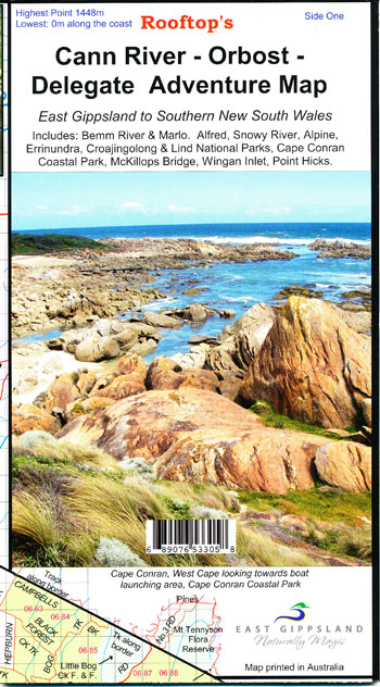
Cann River Orbost Delegate Map Rooftop LAMINATED
$23.00
Description:
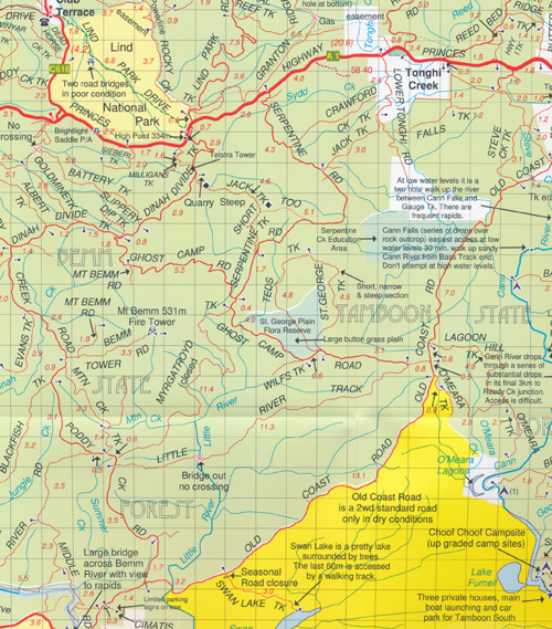
Coverage extends from Orbost and McKillops Bridge to Cann Valley Highway and Tamboon Inlet. An inset map on the reverse side covers the coastal access from Cape Conran to Wingan Inlet including Point Hicks, Sydenham Inlet (Bemm River) and Tamboon Inlet.
Inland the map includes Delegate, Bonang, Bendoc, Goongerah, Combienbar, Cabbage Tree Creek, Bellbird Creek, Glen Arte, Murrungowar, Errinundra National Park, Club Terrace, Tubbut, Deddick etc.
Inset maps on the reverse side include:Sydenham Inlet Access Map; Tamboon Inlet Access Map; Huts & Waterfalls – Far East Gippsland; Cape Conran Coastal park & Camping Area; Attractions Around Bendoc; Neville Falls – Princes Hwy Map; Suggan Buggan – Willis Map; Coastal Access Map: Cape Conran – Wingan Inlet.
Scale of main map is 1:100,000. Roads and tracks have been carefully field-checked in 2007 / 2008 using GPS technology.
Barcode 689076533058