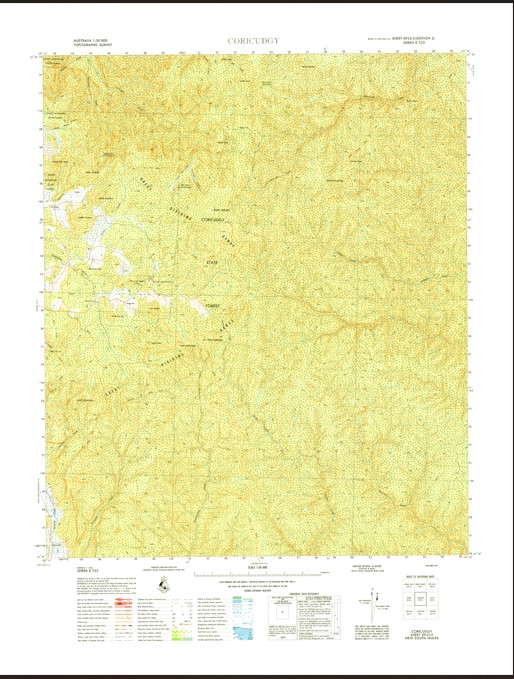
Coricudgy 1-50000 Topographic Map 8932-2 NSW
$16.95 – $31.95
Description:
Print on Demand
Locations within this Map
Mollethe Mycumbene Inglewood Kelgoola The Nile Nilethe Tayar Brookside Mount Baker Bare Rock Bare Rock Bluff The Bluff Bin Ben Binben Mount Mount Boonbourwa Box Hole Clearing Coorongooba Coorongooba Creek Mount Coorongooba Mount Coriaday Coricudgy Coricudgy Creek Mount Coricudgy Coricudgy State Forest Cyrils Rocks Mount Darcy Mount Davis Mount Duran Duran Eugenia Creek Gavins Creek Grassy Mountain Hanging Rock Harris Hole Jamison Jones Hole Jones Hole Creek Kekeelbon Mountains Mount Kelgoola Capertee Peak Dunns Mountain Gavins Swamp Mclean Mead Hill Mount Midderula Middle Hill Mill Creek Mill Swamp Mushroom Flat Native Dog Hill Mount Never Never Nullo Numietta Creek Ovens Creek Phillip Razorback Creek Red Hill Rollen Creek Ross Castle Sassafras Creek Sugarloaf Creek Sugarloaf Swamp The Ovens Mount Wilworril Wollemi National Park Upper Nile Wollemi Mount Boonboourwa
| Name: | Coricudgy |
| Publisher: | Geoscience Australia (Australian Government) |
| Scale: | 1:50000 |
| Latitude Range: | 32° 45.0′ S – 33° 00.0′ S |
| Longitude Range: | 150° 15.0′ E – 150° 30.0′ E |
| Projection / Datum: | Universal Transverse Mercator, GDA94 or WGS84 |
| Approx Print Size: | 0.56m X 0.56m |
| Publication Date: | 1-Jun-74 |


