
Crossland 1-250,000 Topographic Map
Price range: $15.95 through $30.95
Description:
Print on Demand
Locations within this Map
Ainslie Bore Arundel Bore Barbwire Range Barramundi Bore Beefwood Bore Bent Bore Clapp Ridge Dean Hill Djilimbardi Community Double E Bore Eileen Hill Elsa Bore George Bore Hall Range Hicks Range Jack Bore Jones Range Kirkby Range Kirkby Range Bore Kurlku Community Lake Merril Lake Ronnel Luck Bore Mcgovern Dam Middle Bore Millyit Range New Bore Nicholson Swamp No. 8 Bore Purluwarla Community Rowley Rock Saddleback Bore Sans Souci Bore Scrivener Hills Sisters Bore Snowy Claypan Spring Creek Swordfish Bore Three Sisters Tilley Claypan Timber Creek Timber Creek Bore Two Sisters Wambadjilan Bore Worral Range Yard Bore Djilimbardi Kurlku Purluwala
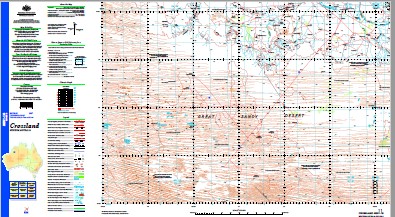
| Name: | Crossland |
| Publisher: | Geoscience Australia (Australian Government) |
| Scale: | 1:250000 |
| Latitude Range: | 19° 00.0′ S – 20° 0.0′ S |
| Longitude Range: | 124° 30.0′ E – 126° 0.0′ E |
| Projection / Datum: | Universal Transverse Mercator, GDA94 |
| Approx Print Size: | 0.44m X 0.67m |
| Publication Date: | 1-Jun-03 |
Read More