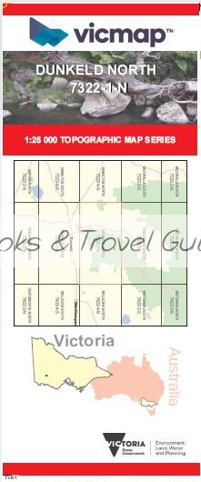

DUNKELD NORTH 1-25,000 Vicmap Topo Map 7322-1-N
Price range: $14.00 through $26.00
Description:
DUNKELD NORTH 1-25,000 Vicmap Topographic Map 7322-1-N Now Print On Demand is used for Walking, 4WD, Fishing, Camping, Motorcycle, both On and Off Road, Gold Prospecting and for those simply going for a family weekend drive.
This is a new series of 1-25,000 scale maps, all sections of Victoria are now covered by these maps, including maps over the South Australian and NSW Borders.
Topographical maps show not only Contours of the Terrain but Walking Tracks, Sealed and Unsealed Roads, Rivers, Creeks, Lakes, Historical Points of Interest, Old Mine Sites mbtg and National and State Park areas.
Main Features of this map includes:
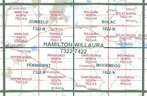
Covers the old edition 1-25,000 Vicmaps Abrupt and Brady Swamp
MOUNT ABRUPT / MOUNT MURDADJOOG, Brady Swamp, Dunkeld Reservoir, Victoria Valley, BAINGGUG, Middletons Crossing, BRYAN SWAMP WR, Freshwater Lake, Freshwater Lake Reserve, Serra Range, mbtg, Cassidy Gap, Grampians Retreat, Lynch’s Crossing Track, Bornes Hill, Heifer Swamp, Walker Swamp
You may also like…
-
The Grampians Special 1-100,000 Topo Vicmap
Price range: $12.00 through $24.00Select options This product has multiple variants. The options may be chosen on the product page -
Grampians Peaks Trail Map South
Price range: $9.95 through $24.95Select options This product has multiple variants. The options may be chosen on the product page -
Dunkeld 1-50,000 Vicmap
Price range: $12.00 through $24.00Select options This product has multiple variants. The options may be chosen on the product page