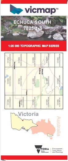

ECHUCA SOUTH 1-25,000 Vicmap Topo Map 7825-1-S
Price range: $14.00 through $26.00
Description:
ECHUCA SOUTH 1-25,000 Vicmap Topographic Map 78251S Now Print On Demand is used for Walking, 4WD, Fishing, Camping, Motorcycle, both On and Off Road, Gold Prospecting and for those simply going for a family weekend drive.
This is a new series of 1-25,000 scale maps, all of Victoria is now covered by these maps, including maps over the South Australian and NSW Borders.
Topographical maps show not only Contours of the Terrain but Walking Tracks, Sealed and Unsealed Roads, Rivers, Creeks, Lakes, Historical Points of Interest, Old Mine Sites, mbtg and National and State Park areas.
Main Features of this map includes:
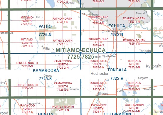
Covers the old series Echuca South and KOYUGA
Murray River Campaspe River and Goulburn River
Echuca, part of the Murray River, Kanyapella, Barep, Barooga Road Bridge, Bringenbrong Bridge, Yambuna, edge of Lower Goulburn National Park, Yambuna Creek, mbtg, Kanyapella Water Authority Land, Beattie Depression Floodway, Echuca Airfield, Bay of Biscay Bridge, Kanyapella South, Koyuga, Tongala, Yarraby Caravan & Holiday Park, Mckerrow Bend Camping Area, Rich River Tourist Park, Campaspe Park Raceway, Yarraby Caravan & Holiday Park, Yambuna Bridge
You may also like…
-
Echuca 1-50,000 Vicmap
Price range: $12.00 through $24.00Select options This product has multiple variants. The options may be chosen on the product page -
Fishing and Camping the Goulburn River AFN
Select options This product has multiple variants. The options may be chosen on the product page -
ECHUCA NORTH 1-25,000 Vicmap Topo Map 7825-1-N
Price range: $14.00 through $26.00Select options This product has multiple variants. The options may be chosen on the product page -
Cohuna Echuca Gunbower Map Hayman
Price range: $12.95 through $25.00Select options This product has multiple variants. The options may be chosen on the product page