
Far South Coast Map NSW Forestry Folded and Flat
Price range: $14.00 through $26.00
Description:
Far South Coast Map NSW Forestry Folded and Flat
SINGLE SINDED MAP ONLY Folded, FLAT PAPER AND FLAT LAMINATED ALSO AVAILABLE
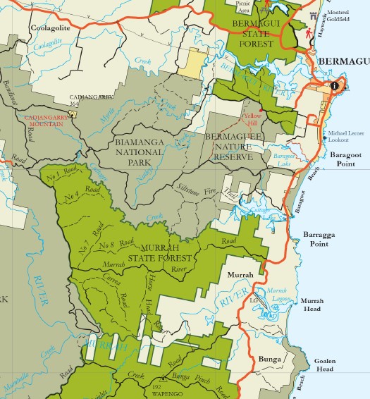
The Far South Coast Forest Map covers the area from Bermagui south to Mallacoota and inland to Bombala. An abundance of recreational pursuits behold within the vast landscape of native forests and plantation pine.
The map shows all regularly maintained roads and trails, walking tracks, recreation areas and lookouts. The reverse side contains photographs and commentary on the history of the regions’ forests and forestry in the area, and details of recreation sites, including the must-see sites and a recreation facilities matrix.
The Far South Coast Map is a great tool for mountain bike riders, four-wheel-drive enthusiasts, bushwalkers, horseriders, dog owners and anyone who wants to explore the region’s extensive public forest estate.
The Far South Coast Forest Map was published in October 2009.
Main Features on this map:
Bermagui Mallacoota Cape Howe Green Cape Eden Pambula Ben Boyd National Park Tathra Bega Cuttagee Nimmitabel Bombala Mimosa Rocks Wadbilliga NP Kooraban NP Bermagui State Forest Biamanga NP Murrah ST Tanja SF Bounda National Park Se Forests Gnupa SF Yuramie SF Roughis Beach Nullica SF Egan Peaks NR Mt Imlay East Boyd State Forest Yambull SF Nadgee SF Timbillica SF Towamba SF Alfred NP Bondi SF Nalbaugh SF Cathcart State Forest Coolungubra SF Glen Allen State Forest Dangelong NR
You may also like…
-
Wolumla 1-25,000 NSW Topographic Map 8824-2-N
Price range: $16.95 through $29.95Select options This product has multiple variants. The options may be chosen on the product page -
South Coast Forests Map NSW Forestry
Price range: $12.00 through $24.00Select options This product has multiple variants. The options may be chosen on the product page -
Merimbula Bermagui Adventure Map Rooftop
Price range: $12.95 through $25.00Select options This product has multiple variants. The options may be chosen on the product page