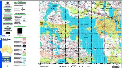
Gairdner 1-250,000 Topographic Map
$15.95 – $30.95
Description:
Print on Demand
Five Mile Tank Goanna Well Diesel Dam Boundary Well Mintabie Well Baldry Rockholes Cloud Burst Dam Kallinta Well Black Tank Well Six Mile Well Little Swamp Bore Yambilpa New Karkulta Dam One Mile Tank Kangaroo Hut Piccadilly Dunefield Mindruba Well Station Hill Roan Well Diamond Yard Lake Hart Post Office dropper Fence Dam Kalanna Creek Charlotte Well Stone Tank Sometime Dam McGregor Bore Reedy Dam Emu Bluff Rocky Creek Dam Sandy Mound Well Hunger Hill Bridle Path Hill Mortar Trig Thomas Bore Mahanewo Terry Tank Kumburta Dam Dunrossil Outstation Moonaree Ten Mile Dam White Sand Hill Mount Sam Waria Water Moonamby South Point Trig Mangaroongah Bore Top Tank Boolatta Creek Altimore Dam Relief Hill Eucolo Hut Charlie Well Coondambo Railway Station Grant Bores Jolly Creek Hawke Well Larry Dam Hiern Tank Mulga Hill Altimore Swamp Butterfield Hill Willigenda Well Stony Top Hill Gorge Well Mulgabby Yarna Water Belt Hill Dam Black Hill Well Four Mile Well Daddys Hill Clucas Hill Five Mile Well Tulangkootra Rockhole Lake Everard Lake Harris Lake Hart Mortimer Hill Fresh Well Neville Bluff Kangaroo Bluff Everard Hill Whitefield Hill Glyde Hill Outstation Canulpoo Well Moramindilba Rockhole Eliza Tank Kalanna Well Monamindilba Rockhole Sisters Dam Meerklebee Hill North Mintabie Well Deep Well Crooks Dam Heirn Dunefield Boolatta South Bore Bullocky Well Horse Well Todd Dam Wirraminna Findlay Dam Coolia Baker Well Bond Hill Shedrack Dam Baldry Dam Lake Jones Well Scorpion Dam North Swamp Dam Karkulta Dam Glenloth Battery Post Office Lake Jessie Gorge Creek Frazer Rockhole Rocky Creek Kokatha Mount Harper Well Werria Moonaree Hill Bluff Dam Moonaree Dunefield McArthur Well Sandy Point Victory Dam Chitanilga Hill Palthrubie Hill Hawks Nest Dam Big Swamp Well Sandy Mound Dam Windina Grant Well Pascoe Well Hope Valley Well Black Hill Mount Harper Dam North Well Belt Hill Coondambo Telephone Office North Swamp Well Pascoe Dam Glyde Hill Mystery Well Wirra Well Cooramundie Dam Skull Camp Tanks Lake Hanson Pinery Well Little Swamp Tank Lake Jones Yeltabinna Creek Yerda Outstation Waria Big Swamp Dam Buttfield Hill Valley Wells Wirraminna Rural School West Dams Koonindo Water Yardleana Yeltabinna Dam Yardin Rockhole Beef Tree Well Station Dam Yedlee Rock Well Wyeela Dam One Mile Well Shedrack Well Cooritta Waters Norton Dam Kangaroo Well Tulangkootra Lake Boolatta North Bore Prospect Hill Yandoolka Well Mount Harper Mulcaree Rockhole Richards Bore Triangle Well Kultanaby Railway Station Fourteen Mile Well Kangaroo Hill Cornish Well Miccolo Dam Lake Hart Tank Pearce Dam Waulalumbo Hill Vic Well Salt Creek Bond Dam Wirraminna Railway Station Floodbird Bore Lake Boomerang Sheep Well Lake Johnstone Rawson Dam Dan Hole Tank Crown Well Taff Tank White Well South Kalanna Dam Glenloth Well Thomas Well Yantea Well Chambuta Smith Shed Mount Mortimer Pilleutta Rockhole Camel Camp Tank Battery Reserve Churchill Dam Mill East Ridge Middle Dam Moonamby Well Waurea Hill North Gate Hill Garden Well Creek Montgomery Dam England Bank Lake Gairdner National Park Pilldetta Water Burando Railway Station Mordinyabee Dam Karnak Well Garden Well Kulgulya Swamp Ian Dam Mordinyabee Hill New Monties Well Flint Trig Chanda Booka Wells Yantia Foote Dam Smith Tank Froghollow Dam Jones Dam Pascoe Hut Last Resort Hill Cook Dams Bullyonna Well Trial Hole Dam Chitanilga Dam Cootra Tanks Blacks Well Rock Hole Dam Boolatta Well Six Mile Yard White Elephant Dam Goalen Bluff Beviss Wells Jubilee Dam Pinery Hut South Well Station Well Two Mile Dam Blue Dam Two Mile Well Block Dam Pinery Dams Kent Dam Lake Gairdner Mount Mordinyabee Wheepool Rockhole Glenloth Katninga Well Middle Tanks Coondambo Coolya Hill Bretts Tank Mills Plateau Yerda Tank Mungaroo Hill Twin Bores Spearfelt Dam Kumburta Homestead Mount Cooper Dam Weepul Water Cooks Hut Well Painter Little Well Wirraminna Hill Gairdner Dam Karculta Catch Frazer Well Sandy Mound Hut Cooritta Hill Cornish Bore Wheepool Wells Wallabin Island Flat Top Hill Kultanaby Siding Goblen Bluff Goulen Bluff Whitfield Hill Yerda Well Cooritta Waterhole Burando Chitanilg Hill Kokatha Station Hierns Tank Waulalumbo Camel Camp Tanks Pine Camp Tanks Mallee Dam Moonamby Rockhole Dingo Hill Charpatta Well Mahanewo Station Grants Well Granits Well Emu Bluff Homestead Taffs Tank Karkulta Well Waurea Well Dans Hole Tank Kelinta Well Ram Well Kumburta Out Station Kumbarta Bullock Well
| Name: | Gairdner |
| Publisher: | Geoscience Australia (Australian Government) |
| Scale: | 1:250000 |
| Latitude Range: | 31° 0.0′ S – 32° 00.0′ S |
| Longitude Range: | 135° 0.0′ E – 136° 30.0′ E |
| Projection / Datum: | Universal Transverse Mercator, GDA94 |
| Approx Print Size: | 0.44m X 0.67m |
| Publication Date: | 1-Jun-99 |


