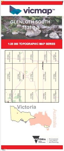
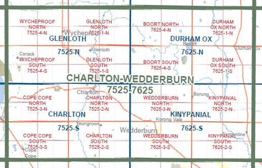
GLENLOTH SOUTH 1-25,000 Vicmap Topo Map 7525-1-S
Price range: $14.00 through $26.00
Description:
GLENLOTH SOUTH 1-25,000 Vicmap Topographic Map 75251S Now Print On Demand is used for Walking, 4WD, Fishing, Camping, Motorcycle, both On and Off Road, Gold Prospecting and for those simply going for a family weekend drive.
This is a new series of 1-25,000 scale maps, all of Victoria is now covered by these maps, including maps over the South Australian and NSW Borders.
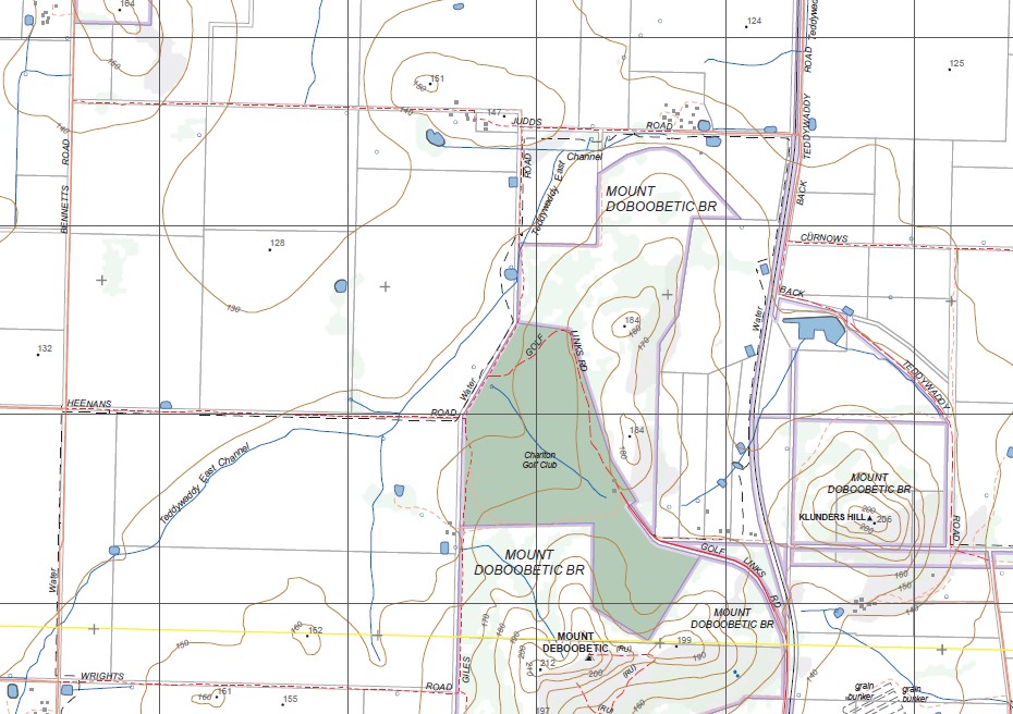
Topographical maps show not only Contours of the Terrain but Walking Tracks, Sealed and Unsealed Roads, Rivers, Creeks, Lakes, Historical Points of Interest, Old Mine Sites, mbtg and National and State Park areas.
Main Features of this map includes:
Glenloth, Nareewillock, Shingle Hut Reserve, Teddywaddy, Shingle Hill HP, Mount Doboobetic BR, mbtg, Charlton West BR, Mount Deboobetic, Klunders Hills, Giles Sand Quarry
You may also like…
-
WYCHEPROOF SOUTH 1-25,000 Vicmap Topo 7525-4-S
Price range: $14.00 through $26.00Select options This product has multiple variants. The options may be chosen on the product page -
Glenloth 1-50,000 Vicmap
Price range: $12.00 through $24.00Select options This product has multiple variants. The options may be chosen on the product page -
GLENLOTH NORTH 1-25,000 Vicmap Topo Map 7525-1-N
Price range: $14.00 through $26.00Select options This product has multiple variants. The options may be chosen on the product page -
WYCHEPROOF NORTH 1-25,000 Vicmap Topo 7525-4-N
Price range: $14.00 through $26.00Select options This product has multiple variants. The options may be chosen on the product page