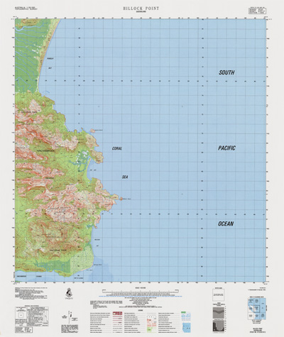
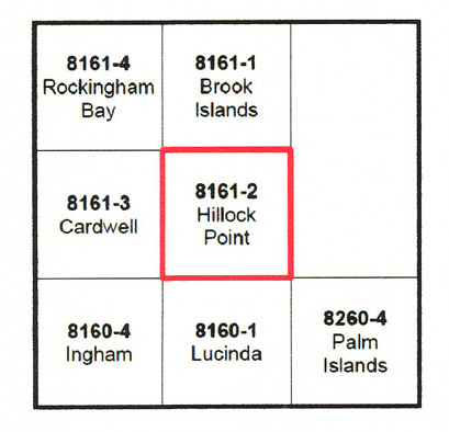
Hillock Point 1-50000 Topographic Map 8161-2 QLD
Price range: $14.95 through $29.95
Description:
Print on Demand
The Eastern half of Hinchinbrook Island
Locations within this Map
Agnes Island Mount Bowen Mount Diamantina Dungeness George Point Goddard Range Hillock Point Mulligan Bay Nina Peak Oyster Rock Picnic Beach Ramsay Bay Straloch Mount Straloch Takalgee The Thumb Waterfall Creek Zoe Bay Neames Creek Seaforth Channel Seaforth Entrance Dungeness Harbour
| Name: | Hillock Point |
| Publisher: | Geoscience Australia (Australian Government) |
| Scale: | 1:50000 |
| Latitude Range: | 18° 15.0′ S – 18° 30.0′ S |
| Longitude Range: | 146° 15.0′ E – 146° 30.0′ E |
| Projection / Datum: | Universal Transverse Mercator, GDA94 or WGS84 |
| Approx Print Size: | 0.56m X 0.56m |
| Publication Date: | 1-Jun-83 |
Read More