

Howitt Selwyn 1-50,000 Vicmap
$12.00
Description:
Out of Print Replaced by Selwyn 1-50,000 Below which will be supplied. Same scale and area of the old series Howitt Selwyn map.
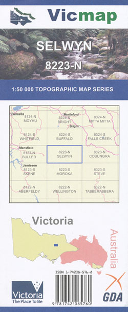
Selwyn 1-50,000 Topographic Map 8223N Vicmap
Selwyn 1-50,000 scale Vicmap Topographical map is used for Walking, 4WD, Fishing, Camping, Motorcycle, both On and Off Road, Gold Prospecting and for those simply going for a family weekend drive.
Topographical maps show not only Contours of the Terrain but Walking Tracks, Sealed and Unsealed Roads, Rivers, Creeks, Lakes, Historical Points of Interest, Old Mine Sites mbtg and National and State Park areas.
Main Features of this map includes:
Replaces the Out of Print Old Series Howitt Selwyn
Australian Alpine Walking Track Section
Wonnagatta Station, Mt Howitt, Mt Selwyn. Mt Buggery, Devils Staircase, Bluff Hut, Mt Speculation, Mt Despair, Dandongadale Remote and Natural Area, Barry Saddle, Razor – Viking Wilderness Zone, Blue Hills, Mount Selwyn, Selwyn, South Selwyn, Tea Tree Range, Galbraith Saddle, BEECHER HILL, MBTG, Blowfly Spur, MOUNT MURRAY, Blue Hills, Razor – Viking Wilderness Zone, Wonnangatta Station, edge of the Wonnangatta Spur, Myrtleford Turn-Off Camping Area, Mount Darling, Mount Darling – Snowy Bluff Wilderness Zone, Homestead Flat Camping Area, Conglomerate Creek Camping Area, Dry River Camping Area, Wonnangatta Track, MBTG, Wombat Gap, Wonnangatta River Reference Area, Mount Darling Gap, Humfrey River Track, Little Baldy, Mount Hart Track, Mount Sarah and Sarah Spur
The edge of Mount Speculation, THE MONUMENT, MONUMENT Saddle, Clear Hills, Pineapple Flat Camping Area, Burnt Top, Razorback, Little Cobbler, King Hut Camping Area, Stanleys Name Gap, The Staircase, Mount Cobbler, Long Jack Creek Natural Catchment Area, Lake Cobbler, MOUNT KOONIKA, Catherine Saddle, Mount Stirling, Mount Despair, Razor – Viking Wilderness Zone, The Razor, The Viking, Viking South
Mount Howitt, Mount Stirling, Grassy Saddle, Third Spur, Third Mile Spur, MOUNT EADLEY STONEY, Rocky Knob, Bluff Hut Camping Area, Waterhole Saddle, Lovicks Hut Camping Area, Picture Point, Helicopter Spur, Upper Howqua Camping Area, Red Rock Saddle, Mount Thorn, The Pimple, MOUNT MAGDALA, MOUNT MARJORIE, Hells Window, mbtg, King Billy 1, King Billy 2, Macalister Area Remote and Natural Area, The crags, THE CROSSCUT SAW, West Peak, Macalister Springs Camping Area, D E V I L S S TA I R C A S E, MOUNT BUGGERY, MOUNT SPECULATION, Howitt Trail Head And Camping Area, Howitt Plains, Howitt Hut And Camping Area, Part of the Bicentenial Track at Howitt Hut, BARSTARDS NECK, Mount Darling – Snowy Bluff Wilderness Zone, WONNANGATTA SPUR