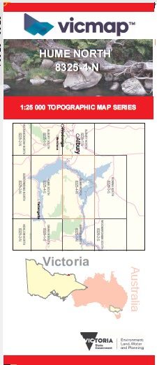
HUME NORTH 1-25,000 Vicmap Topo Map 8325-4-N
Price range: $14.00 through $26.00
Description:
HUME NORTH 1-25,000 Vicmap Topographic Map 83254N Now Print On Demand is used for Walking, 4WD, Fishing, Camping, Motorcycle, both On and Off Road, Gold Prospecting and for those simply going for a family weekend drive.
This is a new series of 1-25,000 scale maps, all of Victoria is now covered by these maps, including maps over the South Australian and NSW Borders.
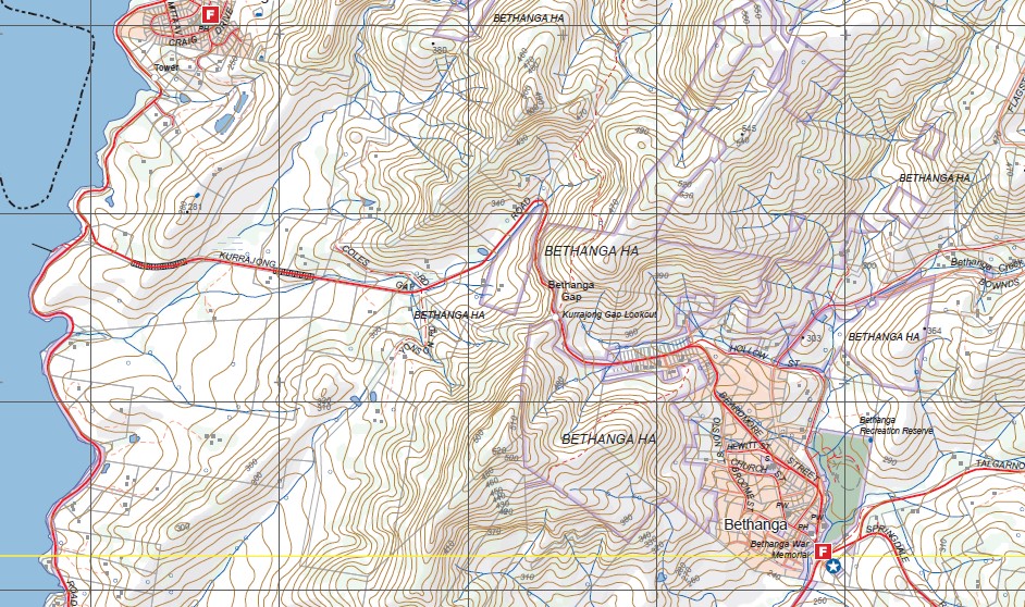
Topographical maps show not only Contours of the Terrain but Walking Tracks, Sealed and Unsealed Roads, Rivers, Creeks, Lakes, Historical Points of Interest, Old Mine Sites mbtg and National and State Park areas.
Main Features of this map includes:
Now also covers the old series 1-25,000 Vicmaps TALGARNO and BETHANGA BRIDGE
Part of the Hume and Hovell Walking Track Lake Hume
Hume Weir, Mitta Junction, BETHANGA Historic Area, Bellbridge. mbtg, MOUNT TALGARNO, Bethanga, TALGARNO, WISES CREEK FR, JARVIS CREEK PLATEAU RP, MOUNT GRANYA State Park
You may also like…
-
HUME SOUTH 1-25,000 Vicmap Topo Map 8325-4-S
Price range: $14.00 through $26.00Select options This product has multiple variants. The options may be chosen on the product page -
Granya 1-50,000 Vicmap Topographic Map 8325-N
Price range: $12.00 through $24.00Select options This product has multiple variants. The options may be chosen on the product page -
GRANYA SOUTH 1-25,000 Vicmap Topo Map 8325-1-S
Price range: $14.00 through $26.00Select options This product has multiple variants. The options may be chosen on the product page -
Beechworth Albury Wangaratta Adventure Map Rooftop
Price range: $11.95 through $25.00Select options This product has multiple variants. The options may be chosen on the product page