King Island 1-100.000 Old Series Tasmap
$10.00
1 in stock
Description:
King Island 1-100.000 Old Series Tasmap
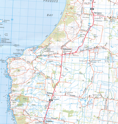
Maps show both man-made and natural features. Roads are symbolized to reflect their surface, accessibility and importance to the State network. Distances between major road intersections and the portrayal of selected addressed buildings aid vehicle navigation. All major reserved land and foot tracks are clearly defined. The shape of the ground is depicted by using a combination of contours (at a 20 metre vertical interval) and hillshading. Both forested and non-forested areas are shown.
| Product Number: | 7618 |
| Edition: | 3 |
| Production Year: | 2013 |
| Datum: | Geocentric Datum of Australia 1994 (GDA94) |
| Scale: | 1:100,000 |
| ISBN 9318923004519
|
|
Read More