

Lalbert 1-50,000 Vicmap
Price range: $12.00 through $24.00
Description:
Lalbert 1-50,000 scale Victorian Topographical map 7526S is used for Walking, 4WD, Fishing, Camping, Motorcycle, both On and Off Road, Gold Prospecting and for those simply going for a family weekend drive.
Topographical maps show not only Contours of the Terrain but Walking Tracks, Sealed and Unsealed Roads, Rivers, Creeks, Lakes, Historical Point of Interest, Old Mine Sites mbtg and both National and State Park areas.
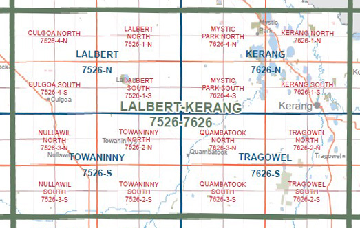
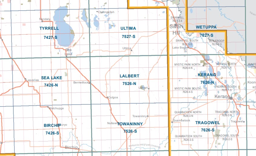
Main Features of this map includes:
Lalbert, Culgoa, Lake Lalbert, Murnungin, Meatian, Murnungin Channel, Magpie Tank BR, Talgitcha Channel, Tittybong, Wangie, Brimy Bill (5 mile lake WR), Lake Lalbert, mbtg, Talgitcha BR, Wangie FFR, Lalbert Creek, Cokam BR
Murnungin, Springfield, Chinangin, Tyrell Creek, Kalpienung Channel, mbtg, Culgoa, Berriwillock War Memorial, Lalbert Creek, Kalpienung Channel, mbtg, Wangie BR, Wangie WR, Wangie FFR, Angels Rest FR, Tyrell Creek SSR
You may also like…
-
Tragowel 1-50,000 Vicmap
Price range: $12.00 through $24.00Select options This product has multiple variants. The options may be chosen on the product page -
CULGOA NORTH 1-25,000 Vicmap Topo Map 7526-4-N
Price range: $14.00 through $26.00Select options This product has multiple variants. The options may be chosen on the product page -
Kerang 1-50,000 Vicmap
Price range: $12.00 through $24.00Select options This product has multiple variants. The options may be chosen on the product page -
LALBERT SOUTH 1-25,000 Vicmap Topo Map 7526-1-S
Price range: $14.00 through $26.00Select options This product has multiple variants. The options may be chosen on the product page -
CULGOA SOUTH 1-25,000 Vicmap Topo Map 7526-4-S
Price range: $14.00 through $26.00Select options This product has multiple variants. The options may be chosen on the product page -
LALBERT NORTH 1-25,000 Vicmap Topo Map 7526-1-N
Price range: $14.00 through $26.00Select options This product has multiple variants. The options may be chosen on the product page -
Wetuppa 1-50,000 Vicmap
Price range: $12.00 through $24.00Select options This product has multiple variants. The options may be chosen on the product page -
Towaninny 1-50,000 Vicmap
Price range: $12.00 through $24.00Select options This product has multiple variants. The options may be chosen on the product page