

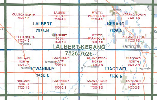
LALBERT KERANG 1-100,000 Vicmap Topo Map 7526-7626
$14.00
Description:
LALBERT KERANG 1-100,000 Vicmap Topographic Map 7526-7626 NOW PRINT ON DEMAND is used for Walking, 4WD, Fishing, Camping, Motorcycle, both On and Off Road, Gold Prospecting and for those simply going for a family weekend drive.
This is a new series of 1-100,000 scale maps, allsections of Victoria are covered by these maps.
Topographical maps show not only Contours of the Terrain but Walking Tracks, Sealed and Unsealed Roads, Rivers, Creeks, Lakes, Historical Points of Interest, Old Mine Sites and National and State Park areas.
Main Features of this map includes:
Kerang, Lalbert, Towninny, Tragowal, Culgoa, Nullawil, Narraport, Dumosa, Kalpienung, Cokum, Kunat, Myall, Quambatook, Oakvale, Barraport, Gredgwin, Budgerum, Budgerum East, Korrak Korrak, Beauchamp, Tresco West, LAKE TUTCHEWOP, Mystic Park, Lake Charm, Kangaroo Lake, Lake Cullen, Lake Bael Bael, Bael Bael, Normanville, Lake Meran, Lake Meran, LEAGHUR STATE PARK, Canary Island, Appin South, Appin, Murrabit, Benjeroop, Yeoburn, Pyramid Creek
You may also like…
-
Towaninny 1-50,000 Vicmap
Price range: $12.00 through $24.00Select options This product has multiple variants. The options may be chosen on the product page -
Lalbert 1-50,000 Vicmap
Price range: $12.00 through $24.00Select options This product has multiple variants. The options may be chosen on the product page -
Kerang 1-50,000 Vicmap
Price range: $12.00 through $24.00Select options This product has multiple variants. The options may be chosen on the product page -
Tragowel 1-50,000 Vicmap
Price range: $12.00 through $24.00Select options This product has multiple variants. The options may be chosen on the product page