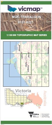

MOE TRARALGON 1-100,000 Vicmap Topo 8121-8221
$14.00
Description:
MOE TRARALGON 1-100,000 Vicmap 8121-8221 NOW PRINT ON DEMAND is used for Walking, 4WD, Fishing, Camping, Motorcycle, both On and Off Road, Gold Prospecting and for those simply going for a family weekend drive.
This is a new series of 1-100,000 scale maps, all of Victoria is covered by these maps.
Topographical maps show not only Contours of the Terrain but Walking Tracks, Sealed and Unsealed Roads, Rivers, Creeks, Lakes, Historical Points of Interest, Old Mine Sites mbtg and National and State Park areas.
Main Features of this map includes:
Moe, Traralgon, Neerim East, SWEETWATER CREEK N.C.R, Rosworth, Hill End, Blue Rock Lake, Willow Grove, Tanjil Bren, Mount Tanjil, MOUNT CARMEL, MOONDARRA, MOONDARRA STATE PARK, Conference Corner, Boola Boola State Forest, Toongabbie, Cowwarr, Winnindoo, Nambrok, Nambrok West, Denison, Myrtlebank, Fulham, Kilmany, Glengarry, Tyers Park, Moondarra Reservoir, Westbury, Buln Buln East, Nilma North, Darnham, Yarragon, Trafalagar, Yallourn North, Newborough, Morwell, Rosedale, Stradbroke West, HOLEY PLAINS STATE PARK, Gormandale, Willung, Hiamdale, Flynns Creek, Flynns Creek Upper, mbtg, Hazelwood, Hazelwood North, Narracan, Thorpdale, MOUNT WORTH STATE PARK, Cloverlea, Cloverlea, Churchill, Jeeralang, Gormandale. Giffard West, Carrajung Lower, Carrajung, MOUNT JOY, GENTLE ANNIE, MOUNT TASSIE, Boolarra, Allambee South, Mount Eccles, Wooreen, Mirboo North, Koorooman, Balook, TARRA-BULGA NATIONAL PARK, Darriman, Won Wron, Dumbalk North
You may also like…
-
MOE SOUTH 1-25,000 Vicmap Topographic Map 8121-1-S
Price range: $14.00 through $26.00Select options This product has multiple variants. The options may be chosen on the product page -
Moe 1-50,000 Vicmap
Price range: $12.00 through $24.00Select options This product has multiple variants. The options may be chosen on the product page -
Walhalla Woods Point Adventure Map Rooftop
Price range: $12.95 through $25.00Select options This product has multiple variants. The options may be chosen on the product page -
MOE NORTH 1-25,000 Vicmap Topographic Map 8121-1-N
Price range: $14.00 through $26.00Select options This product has multiple variants. The options may be chosen on the product page