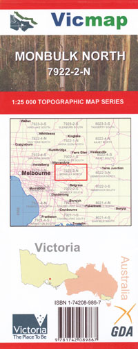
Monbulk North 1-25,000 Vicmap Topographic Map
Price range: $14.00 through $26.00
Description:
Monbulk North 1-25,000 scale Vicmap Topographical map is used for Walking, 4WD, Fishing, Camping, Motorcycle, both On and Off Road, Gold Prospecting and for those simply going for a family weekend drive.
This is a new series of 1-25,000 scale maps, only certain sections of Victoria are covered by these maps.
Topographical maps show not only Contours of the Terrain but Walking Tracks, Sealed and Unsealed Roads, Rivers, Creeks, Lakes, Historical Points of Interest, Old Mine Sites and National and State Park areas.
Main Features of this map includes:
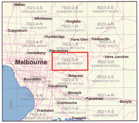
Covers the Old Series Silvan 1-25,000 and replaces the Out of Print KIlsyth
From Ringwood North to Studfield and Seville East to the edge of Yellingbo
The Northern section of the Dandenong Ranges
Mt Dandenong Sassafrass Lilydale Silvan Olinda Wandin
Western Part of the Warburton Trail
Numerous walking Tracks
You may also like…
-
Melbourne 1-250,000 Topographic Map
Price range: $15.95 through $30.95Select options This product has multiple variants. The options may be chosen on the product page -
Warburton Trail 1-25,000 Scale Topographic Maps Vicmap
Price range: $24.00 through $48.00Select options This product has multiple variants. The options may be chosen on the product page -
Monbulk 1-50,000 Vicmap
Price range: $12.00 through $24.00Select options This product has multiple variants. The options may be chosen on the product page -
Dandenong Ranges Lysterfield Hills Map Meridian
Price range: $11.95 through $21.95Select options This product has multiple variants. The options may be chosen on the product page -
Monbulk South 1-25,000 Vicmap Topographic Map
Price range: $14.00 through $26.00Select options This product has multiple variants. The options may be chosen on the product page -
Gembrook North 1-25,000 Vicmap Topographic Map
Price range: $12.00 through $26.00Select options This product has multiple variants. The options may be chosen on the product page