
Monkey Mia 1-250,000 Topographic Map
Price range: $15.95 through $30.95
Description:
Print on Demand
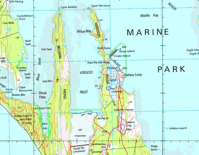
Denham Useless Loop 16 Mile Tank 18 Mile Beach Well 8 Mile Well Ant Island Artesian Bore Baba Bight Baba Head Baba Point Bar Flats Bassett Park Baudin Island Baudin Island Nature Reserve Beethan Outcamp Bellefin Flats Bellefin Prong Bethleham Christian Fellowship Biddy Giddy Outcamp Big Lagoon Big Sandy Mill Black Rocks Blind Inlet Blind Strait Boat Haven Loop Boolbardie Country Club Bore Outcamp Bore Well Bottle Beach Bottom 10 Mile Well Briggs Rocks Broadhurst Bight Broken Down Head Brown Inlet Bulgoo Well Bulla Well Burnt Ground Tank Cape Bellefin Cape Heirisson Cape Inscription Cape Inscription Lighthouse Cape Lesueur Cape Levillain Cape Peron Flats Cape Peron North Cape Ransonnet Cape Rose Cape Rose Tank Capel Well Capewells Camp Bore Cararang Peninsula Caratti Bar Carlabawangy Well Carrarang Cattle Trough Cattle Well Hill Charlie Island Charlie Sappi Park Clough Bar Cocotra Well Colaert Bay Coolboo Well Crayfish Bay Crayfish Bay Well Dampier Landing Dampier Road Denham Channel Denham Sound Depuch Loop Dirk Hartog Dirk Hartog Island Disappointment Loop Disappointment Reach Double Island Double Island Nature Reserve Dubaut Creek Dubaut Point Dubaut Tank Eagle Bluff Eagle Bluff Well Eagle Island East Landing East Sand Eastern Bluff Edel Edel Land Editarra Well Egg Island Egg Island Nature Reserve False Entrance False Entrance Blowholes False Entrance Well Faure Faure Flat Faure Island Fitzys Mill Fording Point Fork Flat Foster Outcamp Four Corners Tank Francois Peron National Park Freycinet Island Freycinet Island Nature Reserve Freycinet Reach Friday Island Gabber Point Garden Point Garden Well George Wear Park Gerritsen Cove Giraud Point Gordon Peters Park Goulet Bluff Graveyard Tank Green Turtle Flat Gregorys Bay Guichenault Point Hamelin Pool Hamelin Pool Marine Nature Resv Hawknest Well Heirisson Flats Heirisson Prong Henri Freycinet Harbour Herald Bay Herald Bay Outcamp Herald Bay Tank Herald Bight Herald Bluff Herald Gut Herald Heights Hopeless Reach Inner Bar Inscription Posts Johnson No. 1 Bore Johnson No. 2 Bore Kangaroo Island Kangaroo Tank Karkura Dunes Kells Rock Knight Bank Kraskoe Tank Lagoon Point Lagoon Point Tank Lake Montbazin Lefebre Island Levillain Shoal L’Haridon Bight Little Lagoon Long Point Longtom Bay Louisa Bay Louisa Bay Well Lovell Tank Lower Part Tank Marinus Point Mary Anne Island Mary Anne Island Nature Reserve Meade Island Middle Bluff Middle Boorabuggatta Well Middle Flat Middle Tank Monkey Mia Monkey Mia Tanks Monkey Rock Monkeytarra Wells Mount Direction Mount Dorrigo Mount Elliot Mystery Beach Nanga Nanga Bay Natta Outcamp Naturaliste Channel New 10 Mile Tank New Bore New Tank Nicholas Bank Nilemah No. 1 Tank No. 1 Well No. 2 Bore No. 2 Well No. 3 Bore North Coast Bore North Guano Island North Guano Island Nature Reserve North Kangaroo Island North Sand Notch Point Old 10 Mile Tank Outer Bar Parrot Island Passage Well Pat Well Pelican Island Pelican Island Nature Reserve Pepper Point Peron Peron Bore Peron Hills Peron Peninsula Petit Point Point Petit Bore Quoin Bluff South Quoin Head Ram Paddock Well Ransonnet Rocks Red Cliff Bay Salutation Island Salutation Island Nature Reserve Sammy Well Sammys Outcamp Sandhill Well Sandy Point Shark Bay Shark Bay Aerodrome Shark Bay Marine Park Shark Bay Primary School Shell Beach Shelter Bay Shoal Flats Six Wells Slope Island Smith Islands Smith Rocks South Guano Island South Guano Island Nature Reserve South Passage South Sand Squatters Tank Steep Point Sunday Bay Sunday Island Sunday Island Nature Reserve Surf Point Taillefer Isthmus Tamala Tetrodon Loop Three Bays Island Three Bays Island Nature Reserve Thunder Bay Thunder Bay Blowholes Top 10 Mile Well Top Burraboogadda Well Town Bluff Towry Well Tumbledown Point Turners Hollow Tank Turtle Bay Turtle Bay Tank Turtle Bay Well Twin Wells Two Wells Unknown Island Useless Inlet Useless Loop Primary School Wale Well War Tank Warren Tank West Coast Well West Point White Island White Island Nature Reserve Wilds Island Wilds Island Nature Reserve Wilson Island Wilya Mia Withnell Point Wolgooda Well Womerangee Bore Womerangee Hill Wumbathama Well Yabbra Well Zuytdorp Cliffs Zuytdorp Tank Cape Peron Point Hautsfonds Attack Bay Guichenot Point Cape Rolland Dirk Hartogs Island The Quoin Bluff The Quoin Bluff South Tetrodon Island Point Refuge Hawks Nest Point Moreau Lharidon Bight Shark Bay Salt Works Hamelin Pool Marine Nature Reserve Branes Rock Lefebre Islet Woonderang Well Dickey Mia Well Epineux Ipineux Head Island Bullda Well Bullda Waterhole Dulverton Bay Epineux Bay Zuytdorp Point Freycinet Islet Freycinet Estuary Henri Freycinet Estuary Smith Islets White Islet Editarra Spring Baudin Islet Leschenault Island Tahmahlee Well
| Name: | Monkey Mia Special |
| Publisher: | Geoscience Australia (Australian Government) |
| Scale: | 1:250000 |
| Latitude Range: | 25° 26.0′ S – 27° 00.0′ S |
| Longitude Range: | 112° 48.0′ E – 114° 6.0′ E |
| Projection / Datum: | Universal Transverse Mercator, GDA94 |
| Approx Print Size: | 0.7m X 0.58m |
| Publication Date: | 1-Jun-02 |