
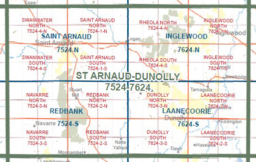
NAVARRE NORTH 1-25,000 Vicmap Topo Map 7524-3-N
Price range: $14.00 through $26.00
Description:
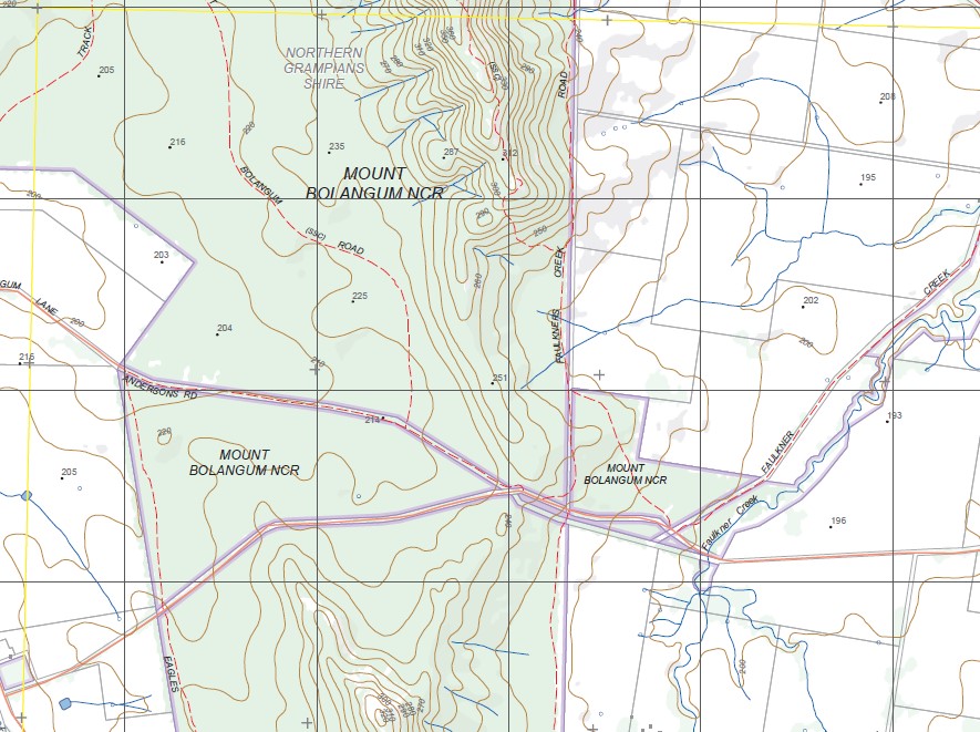
NAVARRE NORTH 1-25,000 Vicmap Topographic Map 75243N Now Print On Demand is used for Walking, 4WD, Fishing, Camping, Motorcycle, both On and Off Road, Gold Prospecting and for those simply going for a family weekend drive.
This is a new series of 1-25,000 scale maps, all of Victoria is now covered by these maps, including maps over the South Australian and NSW Borders.
Topographical maps show not only Contours of the Terrain but Walking Tracks, Sealed and Unsealed Roads, Rivers, Creeks, Lakes, Historical Points of Interest, Old Mine Sites, mbtg and National and State Park areas.
Main Features of this map includes:
Mount Bolangum NCR, Big Tottington NCR, Paradise, McKenzies Bridge, Gifford Bridge, Wingfields Bridge, Rostron, Part of Kara Kara NP, Part of Stuart Mill NCR, Little Tottington SF, Kanya, Darlington Bridge, mbtg, Reedy Creek Bridge, South Bridge, Winjallock, Austerberrys Bridge, Part of The Great Dividing Range The Pyrenees, Stricta Hill, Penningtons Bridge, Dicksons Crossing, Morrl Morrl NCR.