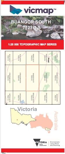
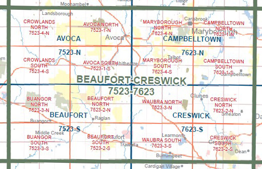
BUANGOR SOUTH 1-25,000 Vicmap Topo Map 7523-3-S
Price range: $14.00 through $26.00
Description:
BUANGOR SOUTH 1-25,000 Vicmap Topographic Map 7523-3-S NOW PRINT ON DEMAND is used for Walking, 4WD, Fishing, Camping, Motorcycle, both On and Off Road, Gold Prospecting and for those simply going for a family weekend drive.
This is a new series of 1-25,000 scale maps, all sections of Victoria are covered by these maps.
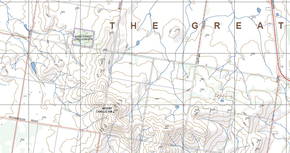
Topographical maps show not only Contours of the Terrain but Walking Tracks, Sealed and Unsealed Roads, Rivers, Creeks, Lakes, Historical Points of Interest, Old Mine Sites MBTG and National and State Park areas.
Main Features of this map includes:
Buangor East, MOUNT CHALLICUM, Ballyrogan, Challicum, Tattyoon North, Fiery Creek, Cross Roads, mbtg, WOODNAGGERAK BR, Middle Creek, KINGS FOREST CHALLICUM NFR, Middle Creek disused Railway Station, mbtg, Shirley
You may also like…
-
BUANGOR NORTH 1-25,000 Vicmap Topo Map 7523-3-N
Price range: $14.00 through $26.00Select options This product has multiple variants. The options may be chosen on the product page -
Beaufort 1-50,000 Vicmap
Price range: $12.00 through $24.00Select options This product has multiple variants. The options may be chosen on the product page -
Beaufort South 1-25,000 Vicmap Topo Map 7523-2-S
Price range: $14.00 through $26.00Select options This product has multiple variants. The options may be chosen on the product page -
BEAUFORT NORTH 1-25,000 Vicmap Topo Map 7523-2-N
Price range: $14.00 through $26.00Select options This product has multiple variants. The options may be chosen on the product page -
The Pyrenees Touring Map Meridian Edition 1
Price range: $15.95 through $26.95Select options This product has multiple variants. The options may be chosen on the product page