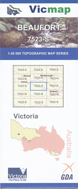
Beaufort 1-50,000 Vicmap
Price range: $12.00 through $24.00
Description:
Beaufort 1-50,000 scale Vicmap Topographical map 7523S is used for Walking, 4WD, Fishing, Camping, Motorcycle, both On and Off Road, Gold Prospecting and for those simply going for a family weekend drive.
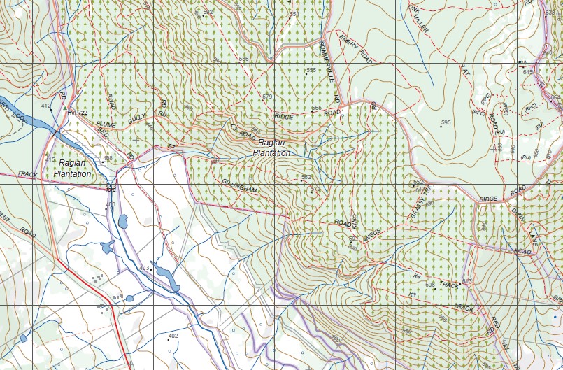
Topographical maps show not only Contours of the Terrain but Walking Tracks, Sealed and Unsealed Roads, Rivers, Creeks, Lakes, Historical Point of Interest, Old Mine Sites ambtg nd National and State Park areas.
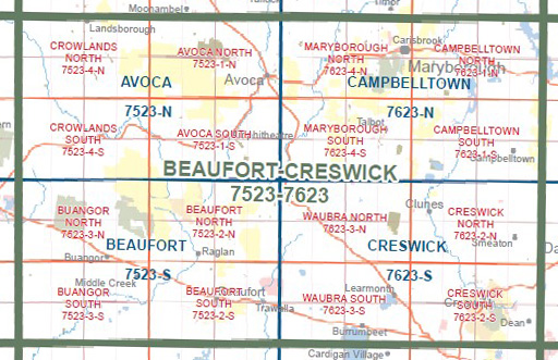
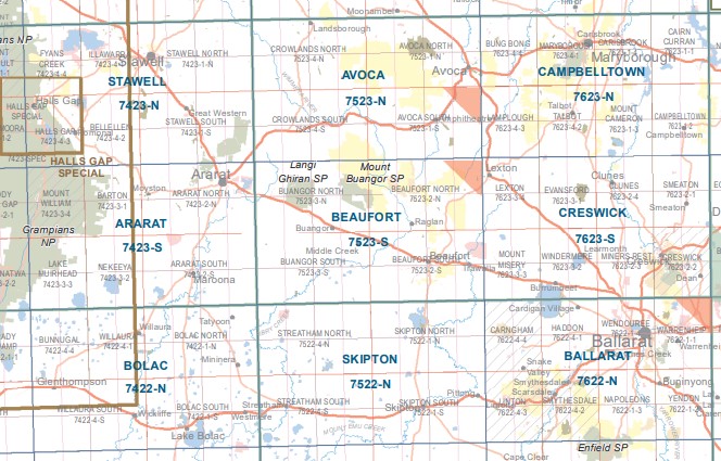
Main Features of this map includes:
Beaufort township
Mount Langi Ghiran State Park, Mount Buangor State Park, The Southern section of Mount Cole, Numerous Gold Diggings and State Parks, Ben Major State Park, Waterloo State Forest, Musical Gully State Forest, Langi Kal Kal, Trawalla State Forest, Raglan, Buangor, Frees Point, Mount Lonarch State Forest, Middle Creek, Andrews State Forest, Buangor State Park, Mount Cole, Harveys Flat, Raglan, Mount Lonach, Mount Cole / Beeripmo SF, Raglan Plantation, Fortes Bush SF, Musical Gully SF, Ben Major SF, Ben Major, Waterloo SF, Granite Hill, mbtg, Beaufort, Buangor East, Musical Gully State Forest, mbtg, Camp Hill Sttate Forest, Andrews State Forest, Nerring, BEAUFORT HAWKWOOD AIRFIELD, Trawalla State Forest, Waterloo, Langi Kal Kal, Mount Ross, Trawalla, Beaufort Mine
Buangor, MOUNT LANGI GHIRAN, Dobie, Warrak, Mount Gorrin, Mount Cole, western part of MOUNT BUANGOR SP, Mount Buangor, Mugwamp Camping Ground, mbtg,Buangor East, MOUNT CHALLICUM, Ballyrogan, Challicum, Tattyoon North, Fiery Creek, Cross Roads, WOODNAGGERAK BR, Middle Creek
You may also like…
-
BUANGOR SOUTH 1-25,000 Vicmap Topo Map 7523-3-S
Price range: $14.00 through $26.00Select options This product has multiple variants. The options may be chosen on the product page -
Stawell 1-50,000 Vicmap Topographical Map 7423-N
Price range: $14.00 through $26.00Select options This product has multiple variants. The options may be chosen on the product page -
Skipton 1-50,000 Vicmap
Price range: $12.00 through $24.00Select options This product has multiple variants. The options may be chosen on the product page -
Creswick 1-50,000 Vicmap
Price range: $12.00 through $24.00Select options This product has multiple variants. The options may be chosen on the product page -
Campbelltown 1-50,000 Vicmap Topo Map 7623-N
Price range: $14.00 through $26.00Select options This product has multiple variants. The options may be chosen on the product page -
BEAUFORT NORTH 1-25,000 Vicmap Topo Map 7523-2-N
Price range: $14.00 through $26.00Select options This product has multiple variants. The options may be chosen on the product page -
BUANGOR NORTH 1-25,000 Vicmap Topo Map 7523-3-N
Price range: $14.00 through $26.00Select options This product has multiple variants. The options may be chosen on the product page -
Avoca 1-50,000 Vicmap
Price range: $12.00 through $24.00Select options This product has multiple variants. The options may be chosen on the product page -
Ararat 1-50,000 scale Vicmap Topo Map 7423-S
Price range: $12.00 through $24.00Select options This product has multiple variants. The options may be chosen on the product page -
Beaufort South 1-25,000 Vicmap Topo Map 7523-2-S
Price range: $14.00 through $26.00Select options This product has multiple variants. The options may be chosen on the product page -
The Pyrenees Touring Map Meridian Edition 1
Price range: $15.95 through $26.95Select options This product has multiple variants. The options may be chosen on the product page