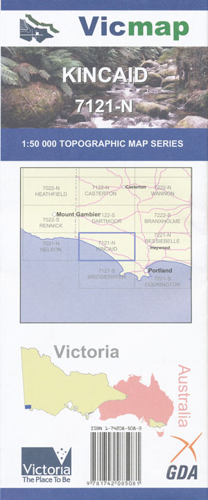
Kincaid 1-50,000 Vicmap
Price range: $12.00 through $24.00
Description:
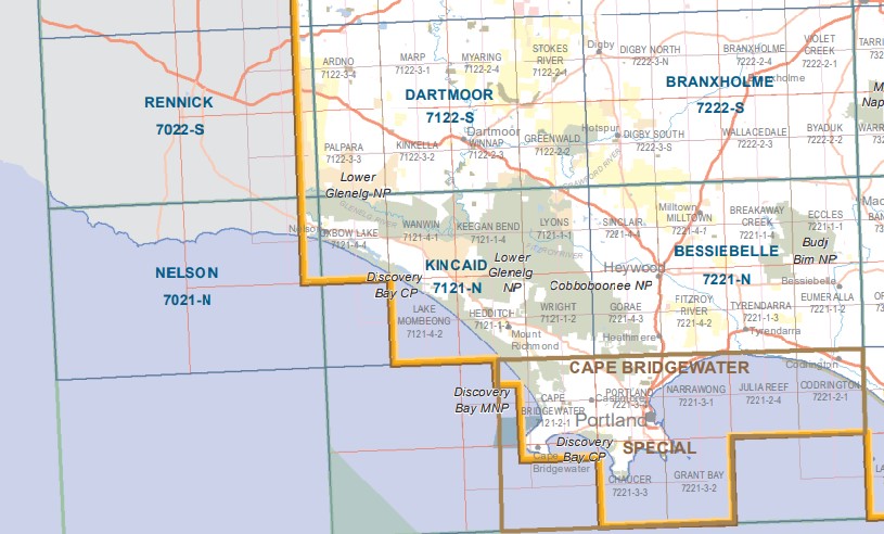
Kincaid 1-50,000 scale Vicmap Topographical map 7121N is used for Walking, 4WD, Fishing, Camping, Motorcycle, both On and Off Road, Gold Prospecting and for those simply going for a family weekend drive.
Topographical maps show not only Contours of the Terrain but Walking Tracks, Sealed and Unsealed Roads, Rivers, Creeks, Lakes, Historical Point of Interest, Old Mine Sites and National and State Park areas.
Main Features of this map include:
Covers the major Walking and Kayaking areas of the Glenelg River and Great South West Walk and Glenelg National Park
Cordover Swamp, part of Croziers Track, part of Cobboboonee NP, Hore Creek, Island Swamp, Red Gum Swamp, Glenaulin Creek, Lyons Plantation, Cobboboonee Forest Park, Lyons Track, mbtg, Dingo Dell Swamp, Surveyors Swamp, Red Hill, Grassy Flats Swamp, Keegans Bend Reference Area, Glenelg River Canoe Trail – Pines Landing Canoe Camping Area, Moleside Creek Falls, Dog Leg Track, part of Great South West Walk, mbtg, Shell Duck Track, part of Pannican Creek Track, The Inkpot, Moleside Creek, Gallows Creek, Mount Vandyke, Fitzroy Camp, Beehive Swamp, Corduroy Track, Corduroy Creek, Pipe Clay Swamp, mbtg, Tremaine Swamp, Kentbruck Heath Reference Area, Gentle Annie, Kentbruck Plantation, mbtg,Gorae West, Kentbruck, Emu Flat, Gentle Annie, Viewpoint Lookout, Lower Glenelg NP, Kentbruck Heath Reference Area, Mount Piccaninny, Kenbruck Track, Carters Track, Cobboboonee Forest Park, mbtg, Wrigth Swamp, part of the Great South West Walk, Scrubbers Creek, Mount Kincaid, Cobboboonee NP, Hedditch Hill, Discovery Bay CP, Telegraph Track, Malseed Lake, Swan Lake, McPhails Creek, mbtg, Mouzie BR, Johnstone Creek FR, Mount Richmond, Kings Well, Enduro Track, Enduro Bike Trail, Mount Kincaid Creek, Hentys Spring, part of the Bridgewater Track, Whites Spring.
Glenelg River Canoe Trail, Nelson SSR, Patteson Canoe Camping Area, Punt Track, River Fire Lane, Lower Glenelg NP, Wilson Hall Track, Wanwin, Keegans Bend Reference Area, part of Glenelg River, mbtg, Shell Duck Track, part of the Great South West Walk, Fence Track, Battersby Camp Ground, Wild Dog Beach, Murrells Track, Wilson Hall Campground, Murrells Camp, Forest Track, Oxbow Lake, mbtg, part of the Glenelg River Mount Walk, Estuary Beach Lookout, Long Swamp, part of Discovery Bay CP, Emerson Track, One Tree Hill, Kentbruck Plantation, Wade Junction, Skipworth Springs Canoe Area, Pritchards Campground, Post and Rail Track, Saunders Track, mbtg, Pannican Creek Track, White Sands Camp, Nobles Rock Track, Jackies Lookout, top of Lake Mombeong, Lake Mombeong, part of Discovery Bay CP, Long Swamp, Cape Montesquieu, Sutton Rocks, Cain Hut Swamp, Smokey Ridge, Dead Horse Swamp.
ISBN 9781742085081
You may also like…
-
NELSON NORTH 1-25,000 Vicmap Topo Map 7121-4-N
Price range: $14.00 through $26.00Select options This product has multiple variants. The options may be chosen on the product page -
KINCAID SOUTH 1-25,000 Vicmap Topo Map 7121-1-S
Price range: $14.00 through $26.00Select options This product has multiple variants. The options may be chosen on the product page -
Nelson Portland Vicmap 1-100,000 Topo 7121-7221
Price range: $12.00 through $24.00Select options This product has multiple variants. The options may be chosen on the product page -
Nelson 1-50,000 Vicmap
Price range: $12.00 through $24.00Select options This product has multiple variants. The options may be chosen on the product page -
NELSON SOUTH 1-25,000 Vicmap Topo Map 7121-4-S
Price range: $14.00 through $26.00Select options This product has multiple variants. The options may be chosen on the product page -
Cape Bridgewater Special 1-50,000 Vicmap
Price range: $12.00 through $24.00Select options This product has multiple variants. The options may be chosen on the product page -
Bessiebelle 1-50,000 Vicmap
Price range: $12.00 through $24.00Select options This product has multiple variants. The options may be chosen on the product page -
KINCAID NORTH 1-25,000 Vicmap Topo Map 7121-1-N
Price range: $14.00 through $26.00Select options This product has multiple variants. The options may be chosen on the product page -
Rennick 1-50,000 Vicmap
Price range: $12.00 through $24.00Select options This product has multiple variants. The options may be chosen on the product page -
Dartmoor 1-50,000 Vicmap
Price range: $12.00 through $24.00Select options This product has multiple variants. The options may be chosen on the product page