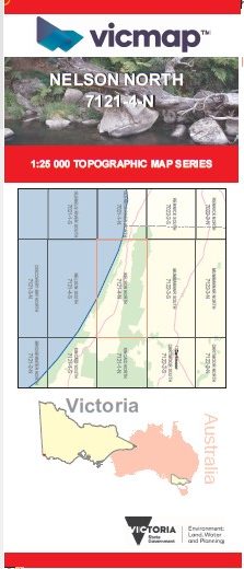
NELSON NORTH 1-25,000 Vicmap Topo Map 7121-4-N
Price range: $14.00 through $26.00
Description:
NELSON NORTH 1-25,000 Vicmap Topographic Map 7121-4-N Now Print On Demand is used for Walking, 4WD, Fishing, Camping, Motorcycle, both On and Off Road, Gold Prospecting and for those simply going for a family weekend drive.
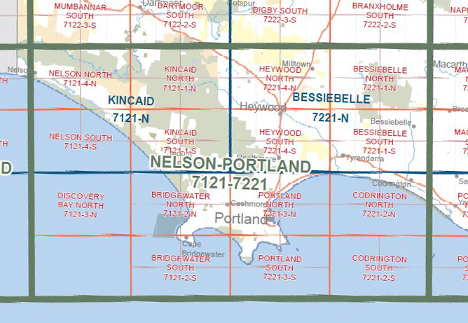
This is a new series of 1-25,000 scale maps, all sections of Victoria are now covered by these maps, including maps over the South Australian and NSW Borders.
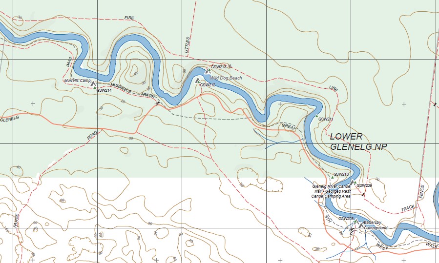
Topographical maps show not only Contours of the Terrain but Walking Tracks, Sealed and Unsealed Roads, Rivers, Creeks, Lakes, Historical Points of Interest, Old Mine Sites, mbtg and National and State Park areas.
Main Features of this map includes:
Now covers the Old Series OXBOW LAKE and WANWIN 1-25,000 maps
Glenelg River Canoe Trail, Nelson SSR, Patteson Canoe Camping Area, Punt Track, River Fire Lane, Lower Glenelg NP, Wilson Hall Track, Wanwin, Keegans Bend Reference Area, part of Glenelg River, mbtg, Shell Duck Track, part of the Great South West Walk, Fence Track, Battersby Camp Ground, Wild Dog Beach, Murrells Track, Wilson Hall Campground, Murrells Camp, Forest Track, Oxbow Lake, mbtg, part of the Glenelg River Mount Walk, Estuary Beach Lookout, Long Swamp, part of Discovery Bay CP, Emerson Track, One Tree Hill, Kentbruck Plantation, Wade Junction, Skipworth Springs Canoe Area, Pritchards Campground, Post and Rail Track, Saunders Track, mbtg, Pannican Creek Track, White Sands Camp, Nobles Rock Track, Jackies Lookout, top of Lake Mombeong
You may also like…
-
Cape Bridgewater Special 1-50,000 Vicmap
Price range: $12.00 through $24.00Select options This product has multiple variants. The options may be chosen on the product page -
NELSON SOUTH 1-25,000 Vicmap Topo Map 7121-4-S
Price range: $14.00 through $26.00Select options This product has multiple variants. The options may be chosen on the product page -
Nelson Portland Vicmap 1-100,000 Topo 7121-7221
Price range: $12.00 through $24.00Select options This product has multiple variants. The options may be chosen on the product page -
KINCAID SOUTH 1-25,000 Vicmap Topo Map 7121-1-S
Price range: $14.00 through $26.00Select options This product has multiple variants. The options may be chosen on the product page -
Kincaid 1-50,000 Vicmap
Price range: $12.00 through $24.00Select options This product has multiple variants. The options may be chosen on the product page -
Nelson 1-50,000 Vicmap
Price range: $12.00 through $24.00Select options This product has multiple variants. The options may be chosen on the product page -
GLENELG RIVER NORTH 1-25,000 Vicmap Topo 7021-1-N
Price range: $14.00 through $26.00Select options This product has multiple variants. The options may be chosen on the product page