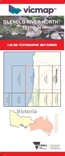
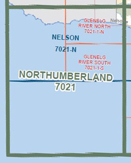
GLENELG RIVER NORTH 1-25,000 Vicmap Topo 7021-1-N
Price range: $14.00 through $26.00
Description:
GLENELG RIVER NORTH 1-25,000 Vicmap Topographic Map 7021-1-N Now Print On Demand is used for Walking, 4WD, Fishing, Camping, Motorcycle, both On and Off Road, Gold Prospecting and for those simply going for a family weekend drive.
This is a new series of 1-25,000 scale maps, all sections of Victoria are now covered by these maps, including maps over the South Australian and NSW Borders.
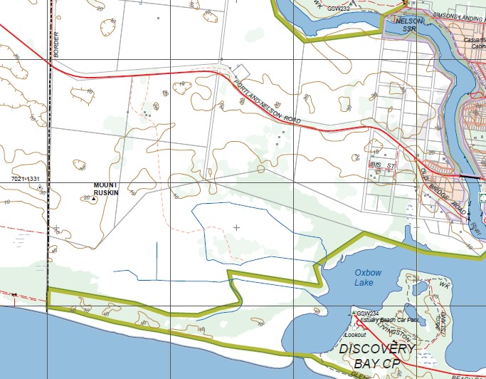
Topographical maps show not only Contours of the Terrain but Walking Tracks, Sealed and Unsealed Roads, Rivers, Creeks, Lakes, Historical Points of Interest, Old Mine Sites, mbtg and National and State Park areas.
Main Features of this map includes:
Half of the map is Ocean. Donvans, part of the Glenelg River, Dry Creek Track, Big Heath Track, McHughs Track, Nelson SSR, Moores Track, Mount Ruskin, Piccaninnie Blue Lake, mbtg, Browns Bay Access Track, Danger Point Access Track, Piccaninnie Blue Lake Lookout, Oxbow Lake, part of Glenelg River Mount Walk
You may also like…
-
NELSON NORTH 1-25,000 Vicmap Topo Map 7121-4-N
Price range: $14.00 through $26.00Select options This product has multiple variants. The options may be chosen on the product page -
Nelson 1-50,000 Vicmap
Price range: $12.00 through $24.00Select options This product has multiple variants. The options may be chosen on the product page -
Kincaid 1-50,000 Vicmap
Price range: $12.00 through $24.00Select options This product has multiple variants. The options may be chosen on the product page