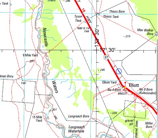
Newcastle Waters 1-250,000 Topographic Map
$15.95 – $30.95
Description:
Locations within this Map
15 Mile Yard 9 Mile Yard Benaud Bore Bill Lawry Tank Botham Bore Botham Tank Bradman Bore Braimers Dam Bruce Laird Bore Bucket Creek Bucket Creek Bore Bucket Waterhole Burge Bore Carruthers Tank Cassius Clay Bore Cassius Clay Tank Causeway Bore Clive Lloyd Bore Conservation Bore Coolibah Yard Desert Bore Fenech Bore Frazier Bore And Yards Garfield Sobers Tank George Redmond Crossing Goochegoochena Creek Grimmett Bore Hassett Bore Hayfield No 1 Bore Hayfield No 3 Bore Hickety Bore Hoad Bore Holding Bore Howell Ponds Ian Redpath Bore Jack Dempsey Bore Joe Louis Bore Joel Garner Tank Johnannsen Bore Jones Store Newcastle Waters Keith Stackpole Tank Laver Tank Leonard Tank Longreach Bore Longreach Waterhole Longreach Yard Marlinja Marshall Bore Mc Kay Bore Mud Bore Mundine Bore Murranji Murranji Landing Ground New Hickety Bore Newcastle Creek Newcastle Waters Newcastle Waters School No 1 Bore No 4 Bore No 6 Bore No 7 Bore No 9 Bore Number 9 Bore Patterson Bore And Yard Rick Mccosker Bore Rocky Marciano Bore Rose Bore Rosewell Bore Ross Creek Ross Creek Bore Steelcon Bore Sturt Plain Bore Town of Newcastle Waters Trimble Tank U 783 Windy Bore Number Seven Bore Howells Ponds Frazier Bore and Yards Frazier Bore Number Six Bore Patterson Bore and Yard Patterson Bore Winturukuji North Newcastle Waters Number One Bore
Print on Demand
| Name: | Newcastle Waters |
| Publisher: | Geoscience Australia (Australian Government) |
| Scale: | 1:250000 |
| Latitude Range: | 17° 0.0′ S – 18° 00.0′ S |
| Longitude Range: | 132° 0.0′ E – 133° 30.0′ E |
| Projection / Datum: | Universal Transverse Mercator, GDA94 |
| Approx Print Size: | 0.44m X 0.67m |
| Publication Date: | 1-Jun-00 |


