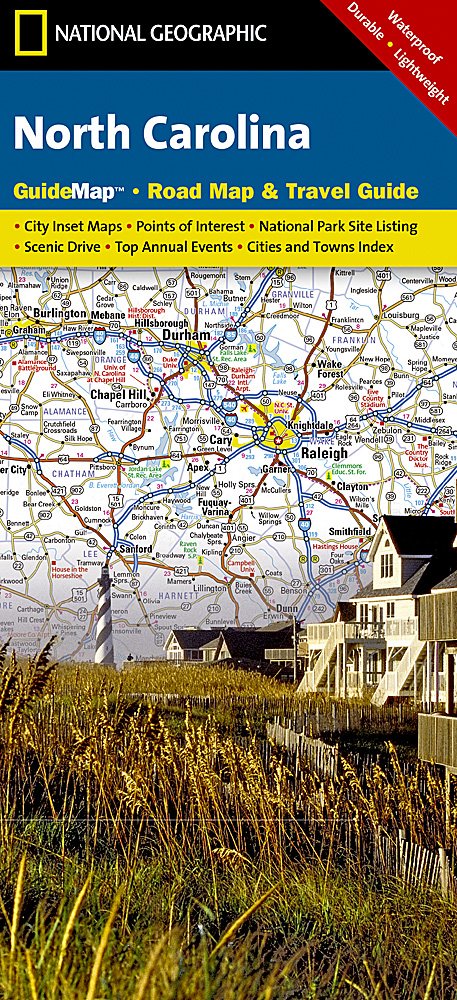
North Carolina Map National Geographic
$21.95
1 in stock
Description:
North Carolina Map National Geographic
National Geographic’s North Carolina Guide Map is designed to meet the needs of travelers with detailed and accurate cartography and loads of helpful information about the state’s many attractions. Hundreds of points of interest are shown, along with national and state parks, public campsites, visitor information centers, airports, ski areas, hospitals, and more. Cities and towns are clearly indicated and easy to find in the user-friendly index. Highways, roadways, toll roads, scenic routes, and other roads, as well as ferry routes are clearly designated. Distances in miles are noted on major highways so travelers can easily plan their best route.
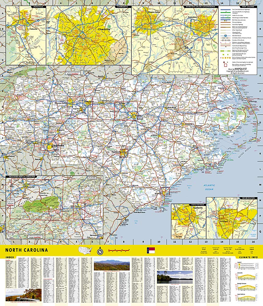
A chart of park service sites and climate information will be particularly helpful to travelers taking in the many outdoor activities in North Carolina. Inset maps of Raleigh-Durham, Asheville, Charlotte, Winston-Salem-Greensboro, Fayetteville, Wilmington, and Western North Carolina provide greater detail of key areas of the state. Maps and information about Blue Ridge Parkway and Great Smoky Mountains National Park highlight some of the extraordinary beauty to be found in the state.
Every State Guide Map is printed on durable synthetic paper, making them waterproof, tear-resistant and tough — capable of withstanding the rigors of any kind of travel.
Waterproof • Tear-Resistant • Travel Map
- Map Scale = 1:1,330,000
- ISBN 9781597750585
- 749717205420