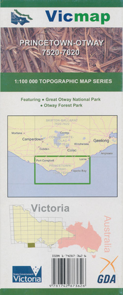
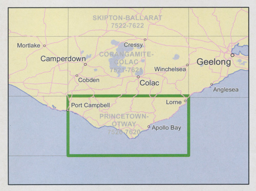
Princetown Otways 1-100,000 Vicmap Topo 7520 7620
Price range: $12.00 through $24.00
Description:
Princetown Otways 1-100,000 Vicmap Topographic Map 7520 7620 NOW PRINT ON DEMAND is used for Walking, 4WD, Fishing, Camping, Motorcycle, both On and Off Road, Gold Prospecting and for those simply going for a family weekend drive.
This is a new series of 1-100,000 scale maps, only certain sections of Victoria are covered by these maps.
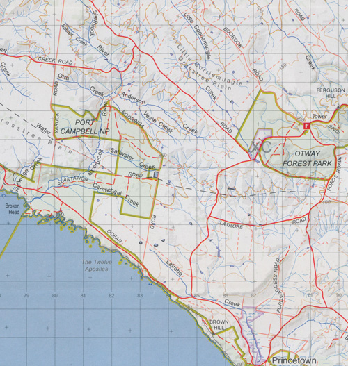
Topographical maps show not only Contours of the Terrain but Walking Tracks, Sealed and Unsealed Roads, Rivers, Creeks, Lakes, Historical Points of Interest, Old Mine Sites and National and State Park areas.
Main Features of this map includes:
Lorne to Port Campbell
Wye River, Kennett River, Forrest, West Barwon Reservoir, Carlise River, Crinoline Creek RA, Kennedy’s Creek, Chapple Vale, Lavers Hill, Marengo, Apollo Bay, Skenes Creek, Cape Otway, Glenaire, Johanna, Horden Vale, Cooriemungle Creek FR, Princetown
Much of the Otways National Park