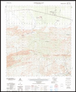
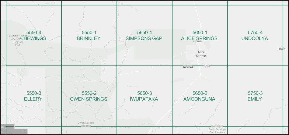
Simpsons Gap 1-50000 Topographic Map 5650-4 NT
Price range: $15.95 through $27.95
Description:
Simpsons Gap 1-50000 Topographic Map 5650-4 NT Print on Demand
Locations within this Map
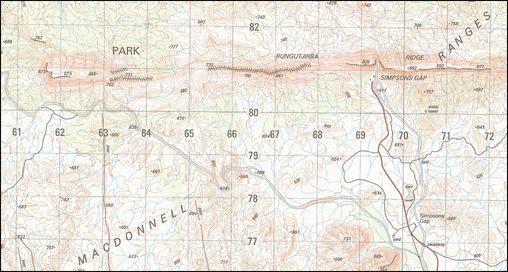
Angatyepe Braitling Bulldust Bore Fish Hole Waterhole Greentree Dam Honeymoon Gap Inbina Atwatye Jay Creek Kunoth Bore Mount Lloyd Mount Solitaire Mount Twellar Mt Everard H F Radio New Well Painter Springs Receiving Station Rungutjirba Ridge Simpsons Gap Simpsons Gap National Park Simpsons Gap Ranger Station Simpsons Gap Visitors Centre Tnerte Twetye A Twetye B Tywenpe A Tywenpe C Werre-Therre Kunoth Well Kunoch Well
| Name: | Simpsons Gap |
| Publisher: | Geoscience Australia (Australian Government) |
| Scale: | 1:50000 |
| Latitude Range: | 23° 30.0′ S – 23° 45.0′ S |
| Longitude Range: | 133° 30.0′ E – 133° 45.0′ E |
| Projection / Datum: | Universal Transverse Mercator, GDA94 or WGS84 |
| Approx Print Size: | 0.56m X 0.56m |
| Publication Date: | 1-Jun-04 |
Read More
You may also like…
-
Oodnadatta to Alice Springs Design Interaction
Select options This product has multiple variants. The options may be chosen on the product page -
Alice Springs 1-100,000 Topographic Map
Price range: $15.95 through $27.95Select options This product has multiple variants. The options may be chosen on the product page -
Alice Springs 1-50000 Topographic Map 5650-1 NT
Price range: $14.95 through $26.95Select options This product has multiple variants. The options may be chosen on the product page