
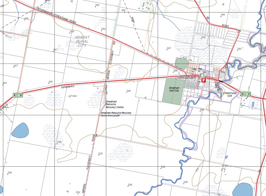
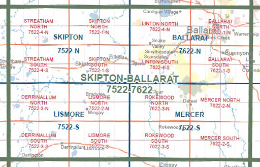
STREATHAM SOUTH 1-25,000 Vicmap Topo Map 7522-4-S
$14.00 – $26.00
Description:
STREATHAM SOUTH 1-25,000 Vicmap Topographic Map 75224S Now Print On Demand is used for Walking, 4WD, Fishing, Camping, Motorcycle, both On and Off Road, Gold Prospecting and for those simply going for a family weekend drive.
This is a new series of 1-25,000 scale maps, all of Victoria is now covered by these maps, including maps over the South Australian and NSW Borders.
Topographical maps show not only Contours of the Terrain but Walking Tracks, Sealed and Unsealed Roads, Rivers, Creeks, Lakes, Historical Points of Interest, Old Mine Sites, mbtg and National and State Park areas.
Main Features of this map includes:
Streatham, Carranballac, Streatham Reservoir, Taylors Lake, Blacks Creek, Chinaman Swamp, Lake McLaren, Broken Creek, Pink Lake, Blue Lake, Lake Kornong WR, Lake Jollicum, Lake Oundell, Nerrin Nerrin Swamp.