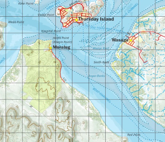
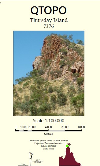
Thursday Island 1-100,000 Topographic Map
$15.95 – $30.95
Description:
Locations within this Map
Bamaga New Mapoon Thursday Island Umagico Injinoo Wasaga Rose Hill Aloa Aplin Pass Asp Shoals Bampfield Head Barn Island Battery Point Bay Point Biffin Creek Big Buttertin Beach Black Rock Boat Channel Bourne Rock Brady Banks Brewster Reef Brisbane Rock Burster Creek Cardale Patch Channel Rock Chapman Reef Cheropo Island Cody Creek Cody Hill Cape Cornwall Cowal Cowal Creek Crab Island Dayman Island Devonshire Rock Dumaralug Island Eagle Rock Edwards Rock Ellis Channel Endeavour Strait Entrance Island Fishbone Creek Flinders Passage Friday Island Friday Passage Galloways Hill Gerard Bank Ghibber Rock Gibson Rock Goods Island Great Woody Island Green Hill Greenant Hill Hammond Island Hammond Rock Harrison Rock Heath Point Herald Patches Heroine Rock Herring Creek High Island Hochepied Head Hood Bank Horn Island Horned Hill Horned Point Hovell Rock Ichera Head Ince Point Inskip Banks Ipili Reef Jackey Jackey Airfield Jackey Jackey Creek Jardine River Jardine Rock Kapuda Islet Karniga Island King Point Kunai Islet Laradeenya Creek Larpent Bank Port Lihou Little Beach Little Roko Island Little Woody Island Lockerbie Loggan Creek Long Beach Madge Reef Marie Rock Markilug Islet Marou Creek Mecca Reef Meddler Island Menmuir Point Milman Hill Mission Hill Mona Rock Mosby Creek Mouinndo Islet Muralug Murangi Islet Mutee Head Nereid Rocks Nona Creek Normanby Sound North West Islet Packe Island Papou Point Paterson Creek Mount Paterson Peak Hill Peak Point Pearl Rock Peebles Shoals Peile Reef Port Lihou Island Possession Island Pott Point Prince of Wales Island Prince of Wales Channel Pullar Patches Pullar Rock Punsand Bay Pym Point Quoin Island Quoin Point Race Rock Rattlesnake Point Red Island Red Island Point Red Point Red Wallis Island Reeves Shoal Roko Island Rothsay Banks Round Island Seisia Seymour Shadwell Point Sherard Osborn Point Simpson Bay Slade Point Smith Point Smyth Creek Somerset Spear Creek Spring Creek Strait Rock Sunk Reefs Sunshine Point Tamwoy Terry Beach Tessy Head The Jardine Swamps Torres Tucker Point Tuesday Islets Tuluaa Islet Turtle Island Van Spoult Head Vivien Point Wai-Weer Islet Wasp Creek Webb Point Wednesday Island Wednesday Spit West Wai Weer Reef Wilson Creek Woody Wallis Island Woomera Creek Wuwurrka Islet Yule Point Possession Island National Park Round Island Conservation Park Punsand Prince of Wales Horn Double Hill Bruce Point Scott Rock Nardana Patches Torres Strait Islands Hood Reef Turtle Head Aade Reeves Shoals Maururra Hammond Islands Keriri Number Two Islet No 2 Islet Number Three Islet No 3 Islet Flinders Pass Number One Islet No 1 Islet Number Four Islet No 4 Islet Hester Hill Pig Hill Goode Island Palilug Diamond Point Bertie Bay Wanetta Powell Point Hovell Bar West Wai-Weer Reef Kate Point Wai-ben Normandy Sound Kunai Island Wilkie Bank Port Kennedy Thursday Island Harbour Normanby Sound Ledge Kiwain Point Madge Reefs Holmes Reef Narupai The Gut Bogan Banks Bold Hill Garagar Point Big Woody Island Kai-Yelubi Island Bampfield Quion Island Meggi-Yelubi Island Peaked Hill Carubaura Despair Cape York Cape York Telegraph Station Djuna Bedanug Roonga Point Tarilug Point Lihou Point Libou Wassel Island Wuwurrka Island Markilug Island Otuckano Creek Lockerie Peebles Shoal Paterson Hill Mouinndo Rock Parau Island Jamunnda Red Wallis Islet Cowal Creek Mission Station Van Speult Point Mutee Mission Mutee Mission Station Ichera Point Black Gin Creek Jardine Swamps
| Name: | 7376 |
| Publisher: | Queensland Government |
| Scale: | 1:100000 |
| Latitude Range: | 10° 30.0′ S – 11° 0.0′ S |
| Longitude Range: | 142° 0.0′ E – 142° 30.0′ E |
| Projection / Datum: | Universal Transverse Mercator, GDA 94 |
| Approx Print Size: | 0.56m X 0.56m |


