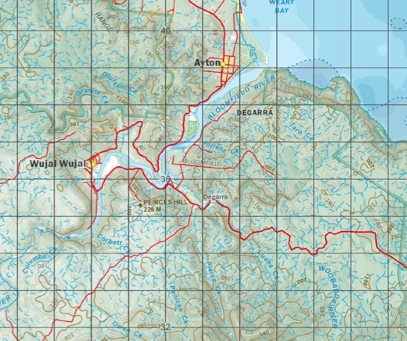
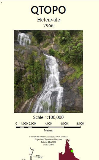
Helenvale 1-100,000 Topographic Map
$15.95 – $30.95
Description:
ocations within this Map
Greenhills Kings Plains Harvest Home Wujal Wujal Adams Gully Alligator Point Amos Bay Mount Amos Mount Amy Anderson Creek Annan Annan River Mount Annie Archer Point Armbrust Creek Ashwell Creek Ayton Baird Creek Bairds Landing Bald Hill Banana Creek Mount Barnett Barrons Range Bauer Inlet Beasley Creek Beasley Lagoon Bee Reef Belle View Peak Bertha Creek Black Mountain Black Trevethan Range Bloomfield River Mount Boolbun North Mount Boolbun South Bowies Gap Box Lagoon Bunk Creek Mount Byerley Byrne Creek Cairns Reef Callaghan Creek Camp Creek Camp Hill Caroline Creek Cedar Bay Cedar Creek Christmas Day Lagoons Chulbil Creek Clerk Collins Hill Cook Mount Cook Corbett Creek Cowie Point Mount Cowie Cowlishaw Reef Culumba Creek Dawson Reef Delius Patch Dog Creek Dowlings Hill Draper Patch East Normanby River North Branch East Normanby River South Branch Mount Ellen Mount Emily Esk River Evandale Mount Fahey Fierce Creek Mount Finlay Finlayson Range Mount Finnigan Fisherman Bend Flat Creek Forsberg Point Frank Creek Fritz Creek Gap Creek Geoffrey Creek Gore Granite Creek Grasstree Pocket Grassy Creek Grave Point Greenhills Creek Gubbins Reef Hamilton Hardwicke Creek Hartley Creek Mount Hartley Mount Hedley Helenvale Mount Helenvale Hicks Hislop Creek Home Rule Home Rule Creek Home Rule Falls Hope Islands Hope Islands National Park Horan Creek Horseplanter Creek Idriess Creek Intake Falls Jackaroo Creek Jones Creek Jubilee Creek Kangaroo Creek Kangkiji Beach Keating Creek Keatings Gap Kings Plains Lake Lake Creek Lake Reef Lambert Creek Le Souef Creek Lee Creek Mount Leswell Lewis Creek Lookout Range Mount Louis Luana Creek Lung Island Lyon Creek Mount Macdonald Madame Berry Mountain Mahmie Peak Malcolm Patch Markie Creek Mount McIntosh Mount McMillan Meelele Creek Meldrum Creek Melissa Creek Middle Oaky Creek Mount Misery Mission Creek Moffat Creek Monkhouse Monkhouse Point Moora Creek Moses Creek Mosquito Creek Mount Muir Mulligan Creek Mungumby Creek New Years Day Lagoons Nolan Creek Nolan Lagoon North Sampson Mountain O’Keefe Creek Oakey Hill Oaky Creek Obree Point Olufson Creek Ottaway Patch Owen Creek Panican Creek Parrot Creek Parsons Creek Patching Creek Peirces Hill Phipps Pooles Lagoon Mount Poverty Rattlesnake Point Roaring Meg Roaring Meg Creek Roberts Creek Rocky Island Rodgers Creek Romeo Creek Mount Romeo Rossville Rossville Creek Royce Creek Russell Creek Saltwater Creek Mount Sampson Samson Creek Sandfly Creek Scrub Island Scrubby Creek Mount Shipton Shiptons Flat Mount Simon Slaty Creek Spit Island Sporing Sporing Creek Spring Creek St George Peak Stockyard Creek Stonor Patch Stony Creek Stuckey Creek Stuckeys Gap Syphon Creek Tableland Bluff Taro Creek Ten Mile Creek The Black Gap The Forks The Little Forks The Lookout Thomas Point Mount Thomas Thompson Creek Three Jins Creek Tidal Creek Mount Tolbert Trevethan Creek Tribulation Walker Bay Walker Hill Walker Point Mount Walker Wallaby Creek Wallace Creek Walsh Bay Ward Creek Waterfall Creek Watermelon Creek Watkins Creek Weary Bay Welch Creek Whalebone Beach Willie Creek Woobadda River Wyalla Plain Yard Creek Mount Yates Yorkey Range Collins Creek Black Mountain National Park Bloomfield River Conservation Park Cedar Bay National Park Keatings Lagoon Conservation Park Archer Point Conservation Park Geraghty Creek Bloomfield Annan River Yuku Baja-Mulika National Park Annan River Yuku Baja-Mulika Resource Reserve Four Mile Gully Degarra Bloomfield Cook Shire Saint George Peak River Esk Cowilshaw Reef Annan River National Park Scott Rock Annan River Resource Reserve Archer Hill Rocky Islet Black Gap Belle Vue Peak Leigh Creek Mine Banana Waterholes Tandewarrah Helenvale Hill Big Tableland Thomas Lorna Doone Mount Finlayson Range North Sampson Mount Samson Mount Finnegan Mount Findlay North Head South Branch East Normanby River North Branch East Normanby River Grass Tree Pocket Normanby Mine Stuckey Gap Mount Boolbun Cowie Hill Dawnvale
| Name: | 7966 |
| Publisher: | Queensland Government |
| Scale: | 1:100000 |
| Latitude Range: | 15° 30.0′ S – 16° 0.0′ S |
| Longitude Range: | 145° 0.0′ E – 145° 30.0′ E |
| Projection / Datum: | Universal Transverse Mercator, GDA 94 |
| Approx Print Size: | 0.56m X 0.56m |


