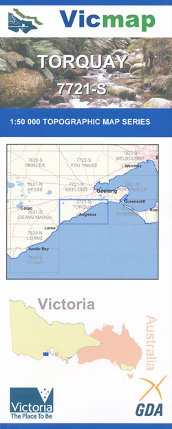
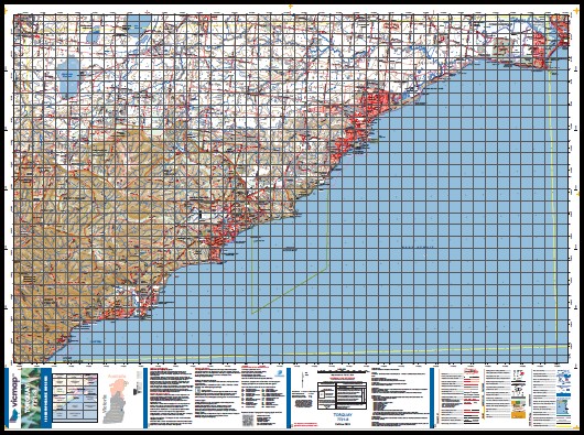
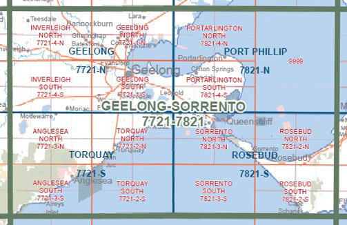
Torquay 1-50,000 Vicmap Topographical Map 7721-S
Price range: $14.00 through $26.00
Description:
Torquay 1-50,000 scale Vicmap Topographical map 7721S is used for Walking, 4WD, Fishing, Camping, Motorcycle, both On and Off Road, Gold Prospecting and for those simply going for a family weekend drive.
Topographical maps show not only Contours of the Terrain but Walking Tracks, Sealed and Unsealed Roads, Rivers, Creeks, Lakes, Historical Points of Interest, Old Mine Sites mbtg and National and State Park areas.
Main Features of this map includes:
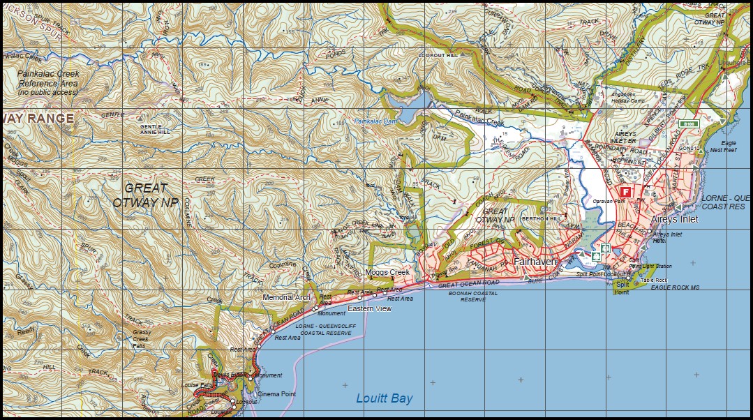
Torquay, Anglesea, Barwon Heads and Aireys Inlet towns
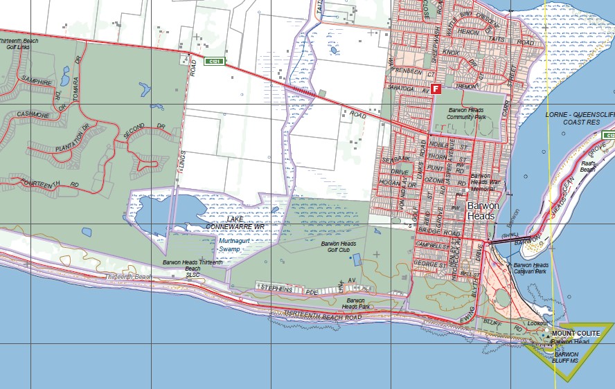
The Eastern section of The Great Otways National Park, Barwon Heads, Connewarre Lake, Connewarre Swamp, Barwon Bluff, Mount Colite, Reef Beach, Thirteenth Beach, Lorne-Queenscliffe Coastal Res, Murtnagurt Swamp, Mount Duneed, Fresh Water Creek, Zealy Bay, Yellow Bluff, Fishermans Beach, Bellbrae, Breamlea FFR, Point Impossible, mbtg, Buckley’s Bay, Noble Rocks, Bancoora Beach, Whites Beach, Point Danger, Voss Lookout, Half Moon Bay, Bird Rock, Bells Beach, Point Addis, part of Great Otway NP, Bell Headland, Jan Juc, mbtg, Part of Great Otway National Park, Bells Beach, Bell Headland, Lorne Queenscliffe Coast Res, Jarasite Headland, Jarosite Mile Track, Point Addis Lookout
Lake Gherang, Wurdiboluc Reservoir, Lake Modewarre, Modewarre, Anglesea River, Boonah Plantation, Wensleydale, Breakfast Creek, Coastal Forest Lodge, mbtg, Angelsea, Otway Forest Park, Boonah Plantation, Peters Hill, Fire Lookout, Hammond Road Campground, Breakfast Creek, Sokil, Pinch Gut Hill, Angelsea Heath Alcoa Agreement Area, Peregrine Track, Harrison Track, Allardyce Track, Angelsea Golf Club, Red River Track, Messmate Track, Angelsea Mine, Shiney Eye Track, mbtg, Ridge View Track, Schrubby Hill, Alcoa Powerline Track, Eumeralla, Point Addis Lookout, Angelsea Beach Front Caravan Park, mbtg, Lorne Queenscliffe Coastal Reserve, Soapy Rock, Point Roadknight Beach, Mount Ingoldsby, Point Roadknight, Batson Track, Whites Track, Bubbs Track, Currawong Falls Track, Denham Track, Melaleuca Swamp, Ironbark Spur, Wickson Spur, Painkalac Creek Reference Area, mbtg, Gentle Annie Hill, Tallawalla, Moggs Creek, Aireys Inlet, Eagle Nest Reef, Great Ocean Road, Split Point Lookout, Tablerock, Eagle Rock, Fairhaven, Surf Coast, Great Ocean Road Memorial Arch, Devils Elbow, Cinema Point, Big Hill, Great Ocean Road Big Hill Monument, Reedy Creek, The Diggers, Clark Spur Track, Eastern View, Berthon Hill, Coalmine Track, Grassy Creek Falls, Urquhart Bluff, Coogoorah Park, Lions Park, Angelsea River, Louitt Bay
You may also like…
-
Lorne 1-50,000 Vicmap
Price range: $12.00 through $24.00Select options This product has multiple variants. The options may be chosen on the product page -
ANGLESEA NORTH 1-25,000 Vicmap Topo Map 7721-3-N
Price range: $14.00 through $26.00Select options This product has multiple variants. The options may be chosen on the product page -
Deans Marsh 1-50,000 Vicmap
Price range: $12.00 through $24.00Select options This product has multiple variants. The options may be chosen on the product page -
TORQUAY SOUTH 1-25,000 Vicmap Topo Map 7721-2-S
Price range: $14.00 through $26.00Select options This product has multiple variants. The options may be chosen on the product page -
TORQUAY NORTH 1-25,000 Vicmap Topo Map 7721-2-N
Price range: $14.00 through $26.00Select options This product has multiple variants. The options may be chosen on the product page