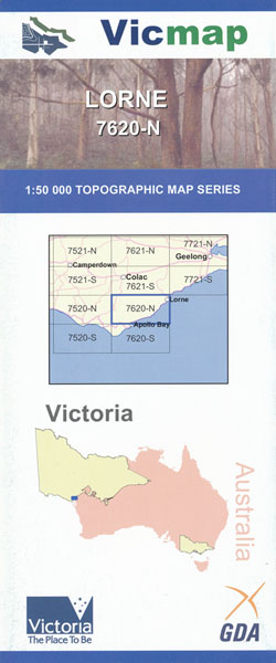
Lorne 1-50,000 Vicmap
Price range: $12.00 through $24.00
Description:
Lorne 1-50,000 scale Victorian Topographical map 7620N is used for Walking, 4WD, Fishing, Camping, Motorcycle, both On and Off Road, Gold Prospecting and for those simply going for a family weekend drive.
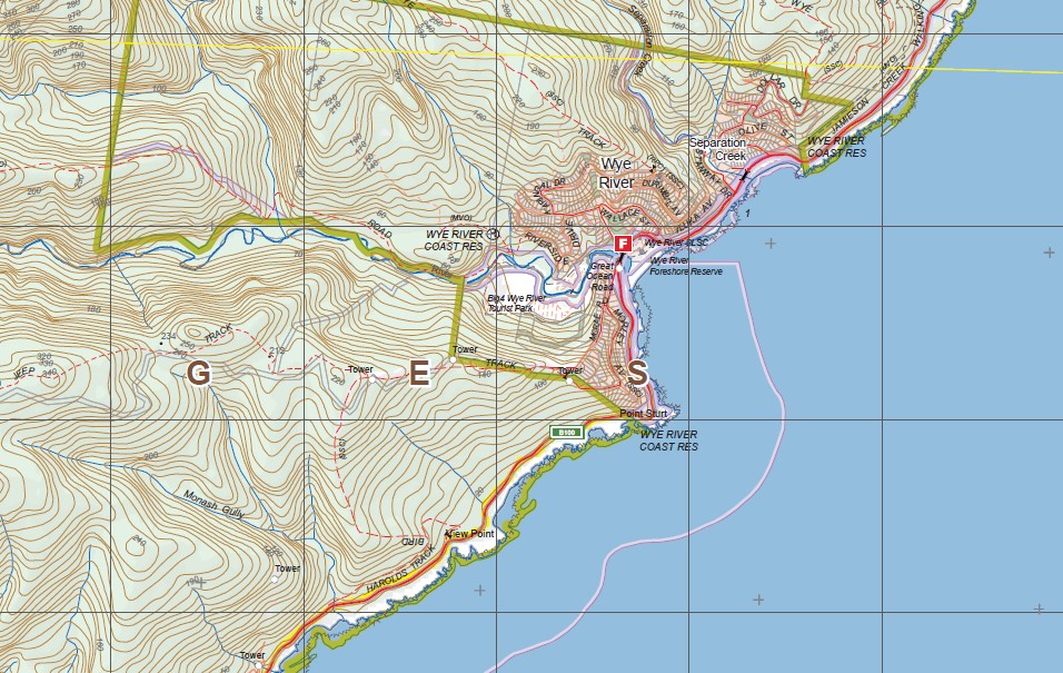
Topographical maps show not only Contours of the Terrain but Walking Tracks, Sealed and Unsealed Roads, Rivers, Creeks, Lakes, Historical Point of Interest, Old Mine Sites mbtg and both National and State Park areas.
Main Features of this map includes:
Lorne, Lorne Queenscliffe Coast, Defiance Falls, Artillery Rocks Lookout, Jamieson Camping Area, Jamieson Track, Godfrey Track, Great Ocean Road, The Brothers, Sheoak Track, Castle Rock, Langdale Pike, Mount Sain George, The Canyon, Mount Defiance, Haines Ridge, Kyles Falls, Erskins Falls, Margaret Falls, mbtg, Mt Cowley, Cowley Track, Middle Spur, Henderson Falls, Cumberland Falls, Ricketts Clearning, Curtis Clearing, Lower Kalimna Falls, Wannathan Falls & Cascade, Upper Cumberland Falls, Galliebarinda Falls, Kennett Spur, Upper Kalimna Falls, Garvey Clearing, Mackie Creek, mbtg, Orchard Creek, Grey River, Mount Meuron, Kennett River Coast Reserve, Point Hawdon, Harolds Track, Sugarloaf Creek, Wye River, Jamieson Creek Walking Track, Separation Creek, Otway Range, Sunnyside Track, Muddy Saddle, Appollo Bay Coast Reserve
Clancy Hill, Gellibrand, Otway Forest Park, The Fork Paddocks, Number One Spur, McRichards Track, Larnders Track, Gravel Pit Track, Upper Gellibrand, Barlidjaru Trail, Barre Warre Trail,Wild Dog Creek SSR, Skenes Creek, Petticoat Creek, Elliott River Addis Bay Coast Reserve, Evans Lookout, Skenes Creek North, Tanybryn Junction, Olangolah Creek Reference Area, Wild Dog Falls, Marriners Ridge Track, Aire Valley, Cape Horn, Great Ocean Road, Triplet Falls, mbtg, Phillips Track, Harvey’s Track, Beauchamps Falls, Cockerhill, Ferguson, Weeaproinah, Bateman Ridge, Hall Ridge
ISBN 9781742085203
You may also like…
-
ANGLESEA NORTH 1-25,000 Vicmap Topo Map 7721-3-N
Price range: $14.00 through $26.00Select options This product has multiple variants. The options may be chosen on the product page -
LORNE SOUTH 1-25,000 Vicmap Topo Map 7620-1-S
Price range: $14.00 through $26.00Select options This product has multiple variants. The options may be chosen on the product page -
Otways Central Walks Waterfall Map Spatial Vision
Price range: $13.95 through $28.95Select options This product has multiple variants. The options may be chosen on the product page -
Torquay 1-50,000 Vicmap Topographical Map 7721-S
Price range: $14.00 through $26.00Select options This product has multiple variants. The options may be chosen on the product page -
Aire 1-50,000 Vicmap
Price range: $12.00 through $24.00Select options This product has multiple variants. The options may be chosen on the product page -
BEECH FOREST NORTH 1-25,000 Vicmap Topo 7620-4-N
Price range: $14.00 through $26.00Select options This product has multiple variants. The options may be chosen on the product page -
ANGLESEA SOUTH 1-25,000 Vicmap Topo 7721-3-S
Price range: $14.00 through $26.00Select options This product has multiple variants. The options may be chosen on the product page -
BEECH FOREST SOUTH 1-25,000 Vicmap Topo 7620-4-S
Price range: $14.00 through $26.00Select options This product has multiple variants. The options may be chosen on the product page -
Princetown Otways 1-100,000 Vicmap Topo 7520 7620
Price range: $12.00 through $24.00Select options This product has multiple variants. The options may be chosen on the product page -
LORNE NORTH 1-25,000 Vicmap Topo Map 7620-1-N
Price range: $14.00 through $26.00Select options This product has multiple variants. The options may be chosen on the product page -
Otways East Surf Coast Map Spatial Vision
Price range: $13.95 through $28.95Select options This product has multiple variants. The options may be chosen on the product page -
Otways Walking Maps Spatial Vision 3 Map Set
Price range: $39.00 through $73.00Select options This product has multiple variants. The options may be chosen on the product page -
Deans Marsh 1-50,000 Vicmap
Price range: $12.00 through $24.00Select options This product has multiple variants. The options may be chosen on the product page