
Upper Murray Adventure Map Rooftop
$14.95
Description:
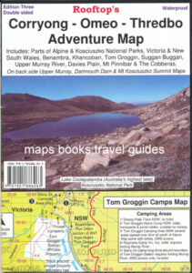
NOW ON THE NEW EDITION CORRYONG OMEO ROOFTOP MAP WHICH WILL BE SUPPLIED IF THIS MAP IS ORDERED
Coverage extends from Albury / Wodonga to Corryong and from the Murray River, south to Mitta Mitta, Dartmouth Village, Glen Dart and Running Creek. The map includes Mount Granya State Park, Lake Hume,mbtg Mount Lawson State Park, Burrowa – Pine Mountain National Park, Mount Mittamatite, Wabba Wilderness plus state forest around Cravensville, Eskdale, Mitta Mitta and Nariel.
Scale is 1:100,000.
Roads and tracks have been carefully field-checked in 2006 / 2007 using GPS technology.
APN 689076913768
The Rooftop Upper Murray Adventure Map now on the back of the Corryong Rooftop Map
Read More