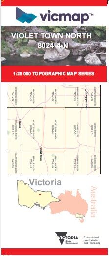
VIOLET TOWN NORTH 1-25,000 Vicmap Topo 8024-4-N
Price range: $14.00 through $26.00
Description:
VIOLET TOWN NORTH 1-25,000 Vicmap Topographic Map 80244N NOW PRINT ON DEMAND is used for Walking, 4WD, Fishing, Camping, Motorcycle, both On and Off Road, Gold Prospecting and for those simply going for a family weekend drive.
This is a new series of 1-25,000 scale maps, all sections of Victoria are covered by these maps.
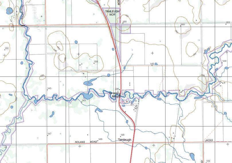
Topographical maps show not only Contours of the Terrain but Walking Tracks, Sealed and Unsealed Roads, Rivers, Creeks, Lakes, Historical Points of Interest, Old Mine Sites mbtg and National and State Park areas.
Now available printed on Waterproof Plastic Paper Folded
Main Features of this map includes:
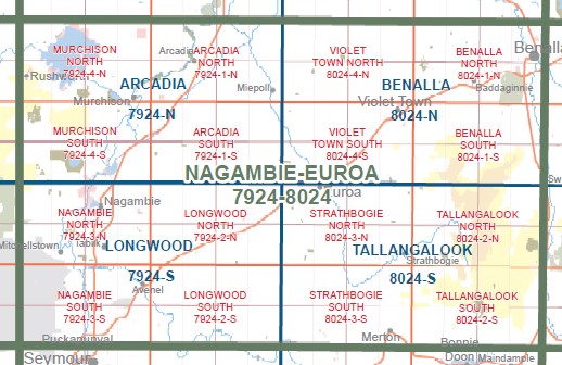
Covers the old series 1-25,000 Vicmaps TAMLEUGH and TAMLEUGH WEST
TAMLEUGH, TAMLEUGH West, Tamleugh West, GUM SWAMP MIEPOL WR, KARRAMOMUS BR, Faithful Creek, MCBURNEY SWAMP WR, CANIAMBO SOUTH NCR, Holyland Plain, LEHMANN SWAMP WR, Frankie Swamp, GOWANGARDIE NCR, Shadforth Reserve
You may also like…
-
Benalla 1-50,000 Vicmap
Price range: $12.00 through $24.00Select options This product has multiple variants. The options may be chosen on the product page -
VIOLET TOWN SOUTH 1-25,000 Vicmap Topo 8024-4-S
Price range: $14.00 through $26.00Select options This product has multiple variants. The options may be chosen on the product page -
BENALLA SOUTH 1-25,000 Vicmap Topo Map 8024-1-S
Price range: $14.00 through $26.00Select options This product has multiple variants. The options may be chosen on the product page -
NAGAMBIE EUROA 1-100,000 Vicmap Topo 7924-8024
Price range: $14.00 through $26.00Select options This product has multiple variants. The options may be chosen on the product page