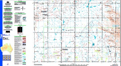
Warri 1-250,000 Topographic Map
$15.95 – $30.95
Description:
Print on Demand
Locations within this Map
Alfred and Marie Range Eastern Land Division Gibson Desert Gibson Desert Nature Reserve Julinu Well Lake Blair Lake Cohen Lake Hancock Mcphersons Pillar Mount Colin Mount Cox Mulgan Rockhole Nipper Pinnacle Warri Well Woolnough Hills Yirril Rockhole Young Range Gibsons Desert McPhersons Pillar Mount Collin
| Name: | Warri |
| Publisher: | Geoscience Australia (Australian Government) |
| Scale: | 1:250000 |
| Latitude Range: | 24° 00.0′ S – 25° 0.0′ S |
| Longitude Range: | 124° 30.0′ E – 126° 0.0′ E |
| Projection / Datum: | Universal Transverse Mercator, GDA94 |
| Approx Print Size: | 0.44m X 0.67m |
| Publication Date: | 1-Jun-03 |
Read More


