

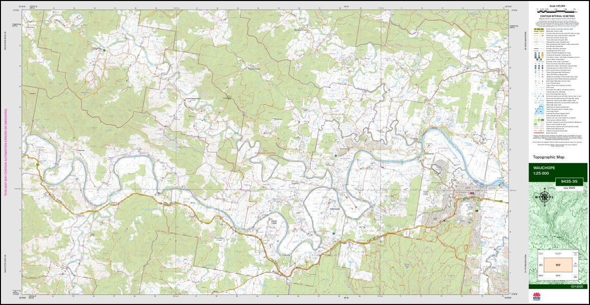
Wauchope 1-25,000 NSW Topographic Map 9435-3-S
Price range: $16.95 through $28.95
Description:
Wauchope 1-25,000 NSW Topographic Map 9435-3-S Print on Demand
Avondale Curragai Cowal Wyandotte Ridge Scrubby Creek Ellengrove Clover Hill Glenrowan Buzzandan Twin Rivers Bellview Lyddington Rosemont Lightning Ridge Lonesome Pines The Cottage Sunny Corner Springvale Big Flat Killmeen Wandoo Park Bimbadeen Glenthorne Crosslands Villers View Yippinvale Ferrett Homelea Raheen Sunnyside Llanthony Greenwood Alton Waters Benwerrin Lillybank Claremont Walibree Moripo Nagundia Myunah Montrose Boodjerri Corner Victoria Downs Renton Fig Tree Valley Hulkiston Colonels Hill Wauchope House Dungowan Farm Hillview Maryellen Beechwood Wauchope Albert Bagnoo Bago Bluff Flora Reserve Bago Lookout Beechwood Public School Bluff Flora Reserve Broken Bago State Forest Brombin Cowangara Gannons Creek Grays Creek Greenbourne Creek Green Wattle Creek Hartys Plains Hollisdale Huntingdon Huntingdon Public School Hyndmans Creek Colonel Grays Creek Green Bourne Creek Hollis Dale Huntington Heights Kings Creek Koree Koree Island Letterewe Lindsays Hill Lindseys Hill Lower Pappinbarra Macquarie Moripo Creek Moropo Creek Mortons Creek Mortons Creek Public School Narran River North Arm Pappinbarra Pipeclay Pipe Clay Pipeclay Creek Pipe Clay Creek Redbank Rosewood Six-B Flora Reserve Snowball Creek South Arm Wauch Wauchope Post Office Andrews Park Bain Park Cameron Falls Fairmount Gardens Frazers Creek Mahers Creek Montrose Park Old Park Rotary Park Sister City Park Wauchope Central Park Wauchope High School Wauchope Primary School Wauchope Public School Wauchope Railway Station Yeppin Creek Yepping Creek Yippin Creek Lasiandra Park Blackbutt Park Wade Park Wauchope Technical College King Creek Quintoc Ridge Cowal Creek Morton Creek South Arm Stony Creek North Arm Stony Creek Hastings Shire Frasers Creek Hursley Creek Pappinbarra Creek Thone River Deep Creek Huntington Lilly Bank Quintoc Hill
| Name: | Wauchope 9435-3-S |
| Publisher: | New South Wales Government |
| Scale: | 1:25,000 |
| Latitude Range: | 31° 22.5′ S – 31° 30.0′ S |
| Longitude Range: | 152° 30.0′ E – 152° 45.0′ E |
| Datum: | GDA 2020
Edition 2025 |
| Approx Print Size: | 0.56m X 1.11m |
You may also like…
-
Port Macquarie 1-25,000 NSW Topo Map 9435-2-S
Price range: $16.95 through $28.95Select options This product has multiple variants. The options may be chosen on the product page -
Kundabung 1-25,000 NSW Topographic Map 9435-1-S
Price range: $16.95 through $28.95Select options This product has multiple variants. The options may be chosen on the product page -
Kempsey 1-25,000 NSW Topographic Map 9435-1-N
Price range: $16.95 through $28.95Select options This product has multiple variants. The options may be chosen on the product page -
Ballengarra 1-25,000 NSW Topographic Map 9435-3-N
Price range: $16.95 through $28.95Select options This product has multiple variants. The options may be chosen on the product page -
Telegraph Point 1-25,000 NSW Topo Map 9435-2-N
Price range: $16.95 through $28.95Select options This product has multiple variants. The options may be chosen on the product page