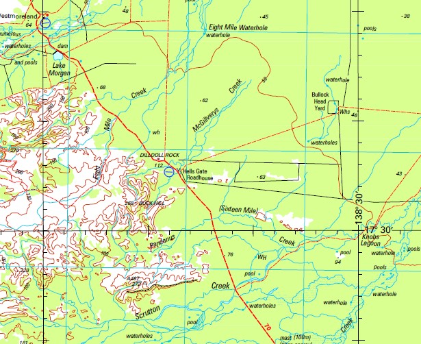
Westmoreland 1-250,000 Topographic Map
$15.95 – $30.95
Description:
Print on Demand
Doomadgee Packsaddle Waterhole Agnew Waterhole Albinia Island Allen Island Andersons Waterhole Appleby Argyle Creek Atlas Creek Ballys Lagoon Bannockburn Lagoon Bare Lagoon Barkly River Battle Creek Beames Beames Brook Bentinck Island Beryl Creek Bessie Island Billicumidji Waterhole Bluff Swamp Bow Waterhole Bowness Branch Creek Brokera Brolgun Brough Buchanan Creek Buck Hill Buffalo Creek Burlong Calshot Camyrallyn Caroline Waterhole Caseys Creek Caseys Waterhole Cattle Crossing Central Creek Chilly Bed Swamp Chilly Bed Waterhole Chookies Creek Cockatoo Swamp Cockatoo Waterhole Coolibah Swamp Corinda Cowoong Creffild Point Cronins Waterhole Crosby Culdara Culdara Creek Culdara Lagoon Desert Creek Dilldoll Rock Drum Swamp Egilabria Eleven Mile Creek Elizabeth Creek Emu Creek Escott Flying Fox Waterhole Forton Four Mile Creek Four Mile Lagoon Gaynor Creek Glenthorn Goose Lagoon Gorge Creek Gorge Waterhole Gosport Greenaway Point Gregory River Gum Hole Hanns Crossing Harrisdale Hawk Nest Lagoon Hedley Hedley Creek Hedleys Creek Hells Gate Inner Island James Creek Johnnys Waterhole Johns Creek Kirke Point Knobs Lagoon Kogoor Konka Ladysmith Waterhole Mount Les Lily Creek Lily Waterhole Llandawk Lorbert Lougharne Maree Margaret Island Marless Marless Creek Marless Lagoon Masgwin McGillverys Creek McKenzie Creek McNelty Creek Middle Creek Middle Swamp Moonlight Creek Moores Creek Nicholson Nierrina Water Facility Nuki One Mile Creek Pandanus Creek Point Parker Patricia Peacock Lagoon Peacock Waterhole Yellow Watehole Creek Pendine Penecoed Percy Creek Peters Creek Phoenix Pioneer Waterhole Rocky Creek Rydal Scrutton Scrutton Creek Seven Mile Creek Seven Mile Swamp Shadforth Creek Six Mile Creek Snake Creek Snake Lagoon Soulby South Wellesley Islands Stoneball Waterhole Stony Creek Symns Yard Waterhole Syrell Creek Tarpot Creek Tarrant Tarrant Point Tebay Teemendar Thalkamurra Waterhole The Knobs Lagoon Titchfield Tomahawk Waterhole Turn Off Lagoons Twelve Mile Creek Walford Walford Creek Wansfell Wattle Creek Wavar Wentworth Westmoreland Wild Horse Creek Wilson Bay Wire Creek Wood Pocket Woods Lake Porchester Hann Creek Nings Waterhole McCarthy Island Parker Point Creffield Point Albino Island South Wellesley Island Kirk Point Crooked Creek Four Mile Waterhole Pioneer Lagoon Lake Morgan Channon Creek Camp Ridgeway Yellow Waterhole Creek McNeltys Creek Escott Waterhole Lilly Waterhole Ethel Creek Henry Creek Teece Camp Lagoon Rocky Waterhole Hawks Nest Lagoon Kingfisher Camp Five Mile Waterhole Ngooderi Beamasbrook Elgilabria Nine Mile Eight Mile Doomadgee Mission Gumhole Border Creek
| Name: | Westmoreland |
| Publisher: | Geoscience Australia (Australian Government) |
| Scale: | 1:250000 |
| Latitude Range: | 17° 0.0′ S – 18° 00.0′ S |
| Longitude Range: | 138° 0.0′ E – 139° 30.0′ E |
| Projection / Datum: | Universal Transverse Mercator, GDA94 |
| Approx Print Size: | 0.44m X 0.67m |
| Publication Date: | 1-Jun-01 |


