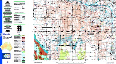
Wooramel 1-250,000 Topographic Map
$15.95 – $30.95
Description:
Print on Demand
10 Mile Bore 12 Mile Bore 2 Mile Well 5 Mile Bore 500 Well 7 Mile Bore 7 Mile Well Albino Bore Alston Well August Well Auto Well Barbaras Bore Barcoo Well Beleeli Well Bend Island Bertie Day Bore Bibras Well Bidgemia Bidgemia Well Big Tank Bigina Bitter Bore Blue Well Boolardy Well Boomerang Bore Boothawallia Spring Boulder Well Boundary Bore Box Gully Boys Bore Browns Well Bundabubba Well Bunegee Well Callagiddy Callagiddy Bore Callytharra Pool Callytharra Springs Camel Well Cardilya Creek Cardooka Bore Carey Downs Carlaweelban Hill Carlson Well Carnarvon Bore Carracut Soak Cattle Bore Chattamurra Swamp Chawner Well Chalga Bore Chilly Well Company Well Cooks Bore Coola Bore Coongan Well Coongaroo Bore Cream Creek Curara Well Currara Bore Curura Well Daves Well De Veres Bore Deep Bore Deep Pool Depot Bore Desperation Well Diedos Bore Dodgers Well Dooewaddah Well Doogalia Pool Doorawarrah Bore Doukers Bore East Lyons Island East Tank Easter Bore Edaggee Ellavalla Far Bore Flethers Well Flowing Bore Fluke Bore Forgotten Bore Frog Bore Garden Well Gascoyne Junction Gascoyne Junction Remote Comm School Gealla Well Gidgee Bore Giggery Well Gilroyd Gladstone Bay Gladstone Jetty Gnardune Pool Government Spring Gulungoor Yammatji Community Hacketts Well Hector Bore Herald Loop House Bore House Well Ilyidabunny Pool Jack Bore Jambatarra Well Jeffrey Bore Jimba Jimba Jimmies Bore Johnnys Bore Johnson Bore Kangaroo Kangaroo Bore Kopke Point Lagoon Bore Leo Well Lindbecks Well Little Gidgea Well Lucky Shot Bore Lyons River Malya Well Marron Maurils Bore Mcewins Bore Mcherberts Well Meaghers Well Meedo Meedo Pool Meenardie Bore Meerabundy Pool Mid Lyons Island Middle Bore Middle Tank Middle Well Mindoola Bore Mongers Well Mongers Well Govt Mooka Bore Moyagee Spring Bore Moyagee Well Mundilya Bore Mundilya Pool Mungarra Creek Murphys Well Myalbie Bore Namararra Well Nelsons Well New Bore New Well New White Well Niagulla Bore Nigallia Creek No Mans Bore No. 1 Bore No. 10 Bore No. 11 Bore No. 15 Bore No. 16 Bore No. 17 Well No. 18 Bore No. 19 Bore No. 2 Bore No. 24 Well No. 24a Well No. 3 Bore No. 4 Bore No. 5 Bore No. 6 Bore No. 7 Bore No. 8 Bore No. 9 Bore Noonury Well Noonyerberry Well North 5 Bore North Coast Bore North Walbinalya Well Nulyanbiddy Pool Nyarra Creek Old Callagiddy Well Outcamp Bore Paddys Bore Partnership Bore Peebro Well Pelican Island Pelican Island Nature Reserve Pells Range Pells Range Well Piddendoora Pool Pimbee Pindan Well Promise Well Pumpkin Bore Quondong Bore Range Bore Rickards Bore Robbers Bore Round Hill Round Hill Bore Salt Gully Salt Gully Bore Salt Well Secret Well Simms Bore Snake Well South Bore South Carlson Bore South Murphys Bore South Nangoolia Bore South Walbinalya Well South Well South Yabidda Well Spinifex Well Stones Bore Stones Well Swan Pool Tarra Well Tetlowes Outcamp Thoodia Bore Toms Well Toodacaraddy Pool Top Mill Well Towrana Turners Well Twins Bore Ullaroo Bore Valentines Bore Viveashs Bore Wahroonga Walkers Well Wallana Claypan Wande Wande Claypan Wandi Bore Wandi-Wandi Well Warrungmool Pool Weaner Well West Bore West Lyons Island West of West Bore West Tank White Bluff Winderie Wingercarrier Well Wingermurra Well Winnemia Pool Wobble Well Wogoola Bore Wolallya Bore Wolalyer Well Wollarrie Bore Wollarrie Pool Woodgamia Community Woogara Bore Woolcadji Bore Woolgary Tank Woombatharra Well Woora Bore Wooramel Wooramel River Wooramel Roadhouse Wooramel Seagrass Bank Wyndham River Wyndham Wash Yabble Yabble Well Yabidda Well Yagina Bore Yalbalgo Yanks Bore Yaringa Yerarri Well Yinni Tank Wallana Swamp Yarrabiddie Well Mungarra Well Lyons Island Clifton Downs Arthur River Walcaroo Well Noonury Spring Marmion Well Edithearea Well Caridr Waterhole Edagee Gnurder Pool Burdalia Well Wolalyer Pool Woolarrie Boothawalla Spring Callatharra Bibras Callytharra Spring Carlaweelban Wuramel River Bibra Landing Gladstone Yaringa North Carnarvon Basin
| Name: | Wooramel |
| Publisher: | Geoscience Australia (Australian Government) |
| Scale: | 1:250000 |
| Latitude Range: | 25° 0.0′ S – 26° 0.0′ S |
| Longitude Range: | 114° 0.0′ E – 115° 30.0′ E |
| Projection / Datum: | Universal Transverse Mercator, GDA94 |
| Approx Print Size: | 0.44m X 0.67m |
| Publication Date: | 1-Jun-04 |


