
PRINCETOWN SOUTH 1-25,000 Vicmap Topo Map 7520-4-S
$14.00 – $26.00
Description:
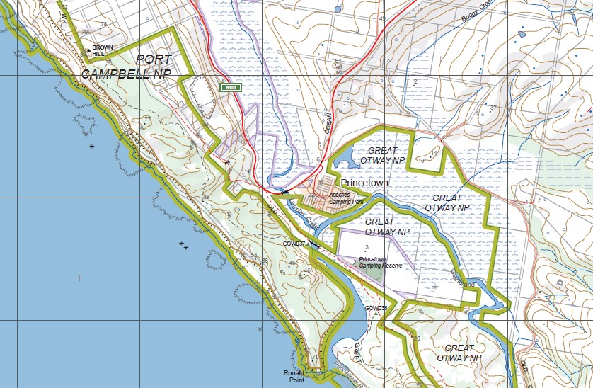
PRINCETOWN SOUTH 1-25,000 Vicmap Topographic Map 7520-4-S Now Print On Demand is used for Walking, 4WD, Fishing, Camping, Motorcycle, both On and Off Road, Gold Prospecting and for those simply going for a family weekend drive.
This is a new series of 1-25,000 scale maps, all sections of Victoria are now covered by these maps, including maps over the South Australian and NSW Borders.
Topographical maps show not only Contours of the Terrain but Walking Tracks, Sealed and Unsealed Roads, Rivers, Creeks, Lakes, Historical Points of Interest, Old Mine Sites mbtg and National and State Park areas.
Main Features of this map includes:
Covers the Old Series Maps Loch Ard and Princetown
Mainly Sea
Part of the Port Campbell National Park, Princetown, The Twelve Apostles, The Achies Marine Sactuary, Loch Ard Gorge, Survey Gorge, Ronald Point, Latrobe BR, Burrupa, Gellibrand Lower, Wattle Hill
You may also like…
-
Otways West Shipwreck Coast Map Spatial Vision
$13.95 – $28.95Select options This product has multiple variants. The options may be chosen on the product page -
The Otways 4WD Map Meridian Edition 4
$14.95 – $26.95Select options This product has multiple variants. The options may be chosen on the product page -
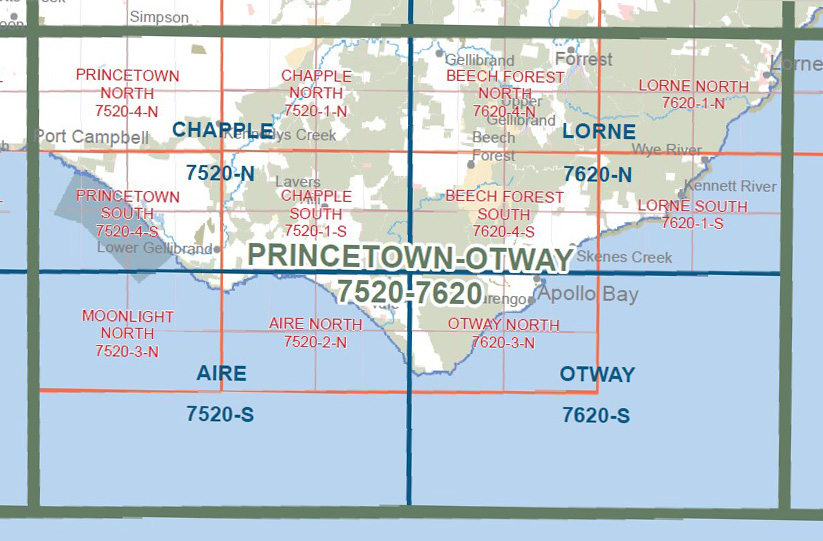
Princetown Otways 1-100,000 Vicmap Topo 7520 7620
$12.00 – $24.00Select options This product has multiple variants. The options may be chosen on the product page -
PRINCETOWN NORTH 1-25,000 Vicmap Topo Map 7520-4-N
$14.00 – $26.00Select options This product has multiple variants. The options may be chosen on the product page