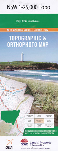
Appin 1-25,000 NSW Topographic Map
Price range: $16.95 through $31.95
Description:
9029-1-S
Appin 90291s 1-25,000 scale NSW Topographical map is usedfor Walking, 4WD, Fishing, Camping, Motorcycle, both On and Off Road, GoldProspecting and for those simply going for a family weekend drive.
Topographicalmaps show not only Contours of the Terrain but also Walking Tracks, Sealed andUnsealed Roads, Rivers, Creeks, Lakes, Historical Point of Interest, Old MineSites and National and State Park areas.
 Laminated and folded NSW Topographical map $12.00 see below
This map includes the following localities: Appin Helensburgh Stanwell Park Stanwell Tops Waterfall Appin Park Appin Public School Arbon Vale Back Creek Back Gully Bald Hill Bee Creek Blue Gum Forest Bishops Corner Branch of Camp Creek Brennans Creek Cataract River Cataract Scout Park Cawleys Saddle Coalcliff Coalcliff Dam Coalcliff Harbour Coalcliff Railway Station Cobbong Creek Coutts Gully Dahlia Dahlia Creek Dahlia Swamp Darkes Forest Darkes Forest Park Darkes Shaft Elladale Creek Flat Rock Creek Flat Rock Junction Flat Rock Swamp Forest Gully Four Mile Creek Gamea Gully Gills Gully Hargraves Creek Haslem Gully Helensburgh Cemetery Helensburgh Park Helensburgh Gully Helensburgh Post Office Helensburgh Public School Helensburgh Railway Station Herbert Gully Honeysuckle Creek Hume Racecourse Iluka Creek Jerusalem Gully Jordans Pass Kellys Falls Canys Creek Coal Cliff Harbour Cobong Creek Coutts Creek Gamea Creek Gills Creek Haslem Creek Heathcote Helensburgh General Cemetery Herbert Creek Herberts Creek Illuka Creek Jerusalem Creek Kingfisher Creek Kings Falls Kings Falls Picnic Area Leafs Creek Leafs Gully Lilly Ponds Creek Lily Ponds Gully Maddens Creek Maddens Creek Crossing Mallaty Creek Marhnyes Hole Mount Morella Morella Ridge Mullaly Creek Myrtle Creek Myrtle Gully Native Dog Hole Nepean Creek O’Hares Creek O’Hares Creek Crossing Ousedale Creek Punchbowl Ripple Rill Rourke Saw-Pit Gully Sawpit Gully Simpsons Creek Stanwell Creek Stanwell Dam Stanwell Park Beach Stanwell Park Public School Stanwell Park Railway Station Stokes Creek Stoney Creek Stony Creek Sydney Water Supply Tenbee Lake Toolooma Tortoise Rock Upper Canal Waterfall Creek Waterfall Gully Waterfall Oval Waterfall Public School Waterfall Railway Station Village of Waterfall Wedderburn Wedderburn Public School Wedderburn State Forest West Cliff Westmacott Mount Westmacott Westmacott Ridge Westmacott Rill Woodhouse Creek Yelgun Cave Yellow Pool Dooundong Burkes Rock Byrne Eckersley New Garawarra State Conservation Area Hacking River (Part Of) Kellys Creek Alan Benn Reserve Kennedy Creek Dharawal State Recreation Area Dharawal Nature Reserve Woronora Woronora Dam Oaklands Park Kennedy Creek Walk A J Brown Reserve
| Scale: | 1:25000 |
| Latitude Range: | 34 07.5 S – 34 15.0 S |
| Longitude Range: | 150 45.0 E – 151 00.0 E |
| Approx Print Size: | 0.56m X 1.11m |
| Projection: | Transverse Mercator |