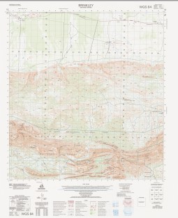

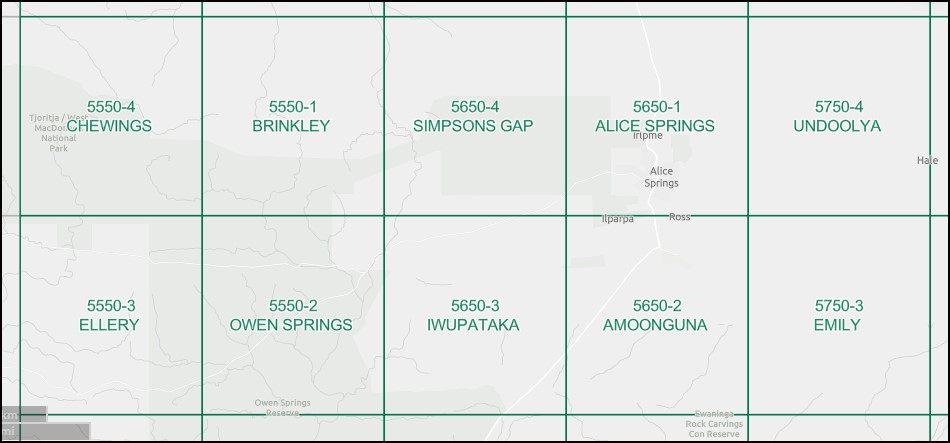
Brinkley 1-50000 Topographic Map 5550-1 NT
Price range: $15.95 through $27.95
Description:
Brinkley 1-50,000 Topographic Map 5550-1 NT Print on Demand
Locations within this Map
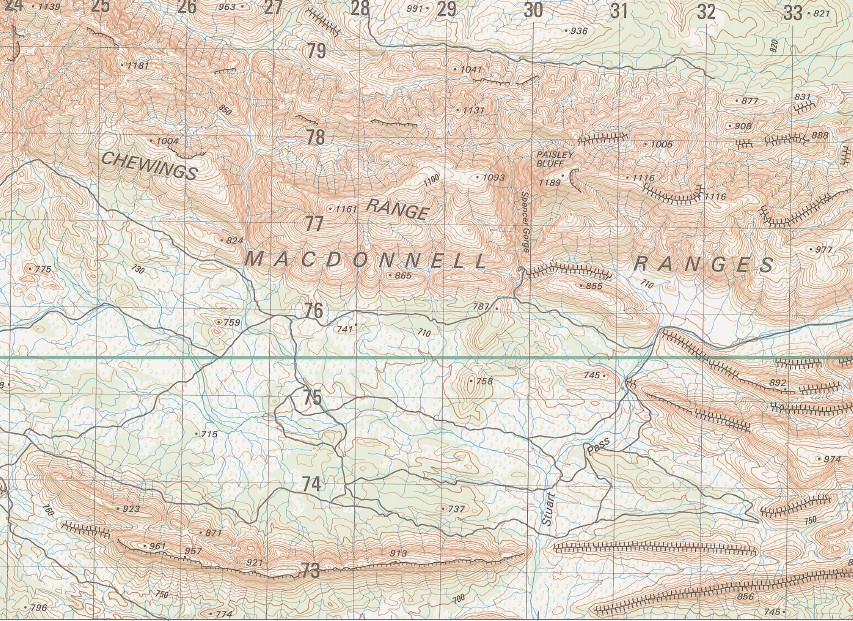
Angkerle Arrenge A Angkerle Arrenge B Blackhill Dam Brinkley Bluff Hamburger Dam Hamilton Creek Hamilton Downs Hanson Bluff Hugh Gorge Mount Conway Old Hamilton Downs Paisley Bluff Spencer Gorge Standley Chasm Stuart Pass Ceildh Well Paisleys Bluff Brinkleys Bluff Macdonnell Ranges
| Name: | Brinkley |
| Publisher: | Geoscience Australia (Australian Government) |
| Scale: | 1:50000 |
| Latitude Range: | 23° 30.0′ S – 23° 45.0′ S |
| Longitude Range: | 133° 15.0′ E – 133° 30.0′ E |
| Projection / Datum: | Universal Transverse Mercator, GDA94 or WGS84 |
| Approx Print Size: | 0.56m X 0.56m |
| Publication Date: | 1-Jun-04 |
Read More
You may also like…
-
Owen Springs 1-50000 Topographic Map 5550-2 NT
Price range: $15.95 through $27.95Select options This product has multiple variants. The options may be chosen on the product page -
Alice Springs 1-50000 Topographic Map 5650-1 NT
Price range: $14.95 through $26.95Select options This product has multiple variants. The options may be chosen on the product page -
Chewings 1-50000 Topographic Map 5550-4 NT
Price range: $15.95 through $27.95Select options This product has multiple variants. The options may be chosen on the product page -
Alice Springs 1-100,000 Topographic Map
Price range: $15.95 through $27.95Select options This product has multiple variants. The options may be chosen on the product page -
Ellery 1-50000 Topographic Map 5550-3 NT
Price range: $15.95 through $27.95Select options This product has multiple variants. The options may be chosen on the product page