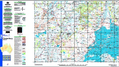
Canterbury 1-250,000 Topographic Map
$15.95 – $30.95
Description:
Print on Demand
Part of the Birdsville Track
Part of the Diamantina Developmental Road
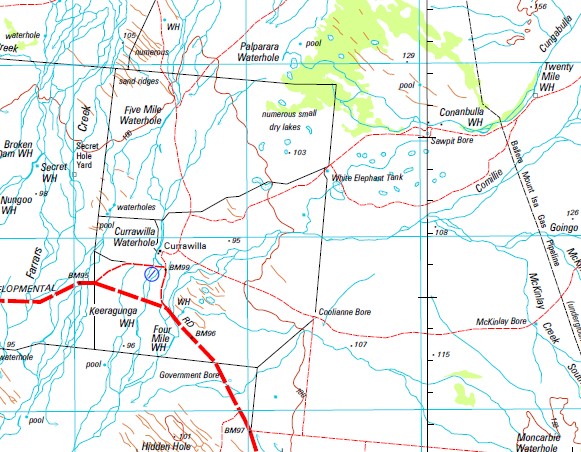
Aruko Mount Baigi Barrago Beal Beal Range Billibooroo Creek Binjula Waterhole Bloodwood Creek Boinia Boompa Waterhole Bullang Waterhole Bulpirrah Bungannya Creek Bungee Burleway Waterhole Mount Butler Campbell Gap Camtank Water Facility Candue Swamps Candue Waterhole Canterbury Cardinals Cap Carella Waterhole Carlpie Caroni Carranya Carrick Coburg Cockatoo Waterhole Coco Waterhole Mount Collins Comillie Creek Conanbulla Waterhole Coolbulla Waterhole Coonthaberri Waterhole Cuddapan Lake Cuddapan Cullilla Waterhole Cumbroo Creek Cungabulla Creek Cungabulla Waterhole Curler Curler Waterhole Currawilla Currawilla Water Facility Currawilla Waterhole Cutt Mountains Dalton Denley Dicola Waterhole Eight Mile Waterhole Eulbertie Five Mile Waterhole Flat Top Four Mile Waterhole Fraser Creek Galalah Creek Gathong Geiger Creek Gidya Creek Gimparrka Creek Goingo Creek Grey Gum Creek Gum Waterhole Haddon Haddon Corner Hamilton Bluff Mount Henderson Ironpot Creek Joanjah Mount John Julago Jump Up Jump Up Gap Karapa Waterhole Keeragunga Waterhole Keg Waterhole Kirrawallie Creek Kyle Langa Maraju Marourah McKinlay Creek North McKinlay Creek South Meeba Downs Merewolt Mirri Modock Money Money Waterhole Monkwilla Water Facility Montecalla Waterhole Moonlight Waterhole Mooraberree Waterhole Moorathulla Moorathulla Waterhole Morney Morney Water Facility Mosquito Creek Muckalara Sandhill Negri Mountains Nullullie Waterhole Nungoo Waterhole Palparara Waterhole Pickle Pickle Waterhole Pig Channel Pinnacle Planet Poolooroo Waterhole Mount Poolpirree Poothree Matoo Waterhole Rockton Round Mountain Scour Waterhole Secret Waterhole Sheep Creek South Galway Spring Creek Strathleven Talpy Waterhole Tanbar Tanbar Billabong Tanbar Creek Tanbar Waterhole Tanborough Waterhole Tanbury Water Facility Tarcarara Tarcarara Creek Three Sisters Toledo Toondah Waterhole Towan Towan Waterhole Triangle Troup Creek Tubs Waterhole Tudor Twelve Mile Creek Twelve Mile Waterhole Ullenburry Creek Ullenburry Waterhole Unthill Waterhole Wade Creek Wallimy Waverney Westby Whitula Whitula Creek Whitula West Water Facility Mount Wilkie Windijo Wombunderry Channel Wombunderry Waterhole Yalilea Yalungah Lagoon Yass Yerpa Yoppa Waterhole Yorakah Yorakah Lagoon Farrars Creek Calabra Cockatoo Yard Manilla Secret Hole Yard Gibber Creek Kings Bore Cuddapan Station Taroarara Creek Wombunderry Out Station Mount Poolpiree Planet Downs Outstation Bull Yard Haddon Creek
| Name: | Canterbury |
| Publisher: | Geoscience Australia (Australian Government) |
| Scale: | 1:250000 |
| Latitude Range: | 25° 0.0′ S – 26° 0.0′ S |
| Longitude Range: | 141° 0.0′ E – 142° 30.0′ E |
| Projection / Datum: | Universal Transverse Mercator, GDA94 |
| Approx Print Size: | 0.44m X 0.67m |
| Publication Date: | 1-Jun-01 |


