

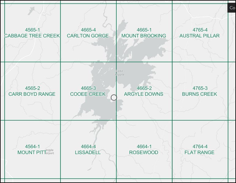
Cooee Creek 1-50,000 Topographic Map 4665-3 WA
Price range: $14.95 through $26.95
Description:
Cooee Creek 1-50000 Topographic Map 4665-3 WA Print on Demand
South West section of Lake Argyle
Locations within this Map
Amethyst Island Balabul Ridge Cooee Creek Bore Flying Fox Knoll Guy Reid Island Lagoon Island Lake Argyle Lily Spit Mary Durack Island Monsmont Island Nalamdarim Point Pumpkin Islands Revolver Creek Ulysses Bay Wood Belly Breakaway Wood Belly Creek Carr Boyd Range Cooee Creek
| Name: | Cooee Creek |
| Publisher: | Geoscience Australia (Australian Government) |
| Scale: | 1:50,000 |
| Latitude Range: | 16° 15.0′ S – 16° 30.0′ S |
| Longitude Range: | 128° 30.0′ E – 128° 45.0′ E |
| Projection / Datum: | Universal Transverse Mercator, GDA94 or WGS84 |
| Approx Print Size: | 0.56m X 0.56m |
| Publication Date: | 1-Jun-89 |
Read More
You may also like…
-
Carlton Gorge 1-50,000 Topographic Map 4665-4 WA
Price range: $14.95 through $26.95Select options This product has multiple variants. The options may be chosen on the product page -
Argyle Downs 1-50000 Topographic Map 4665-2 WA
Price range: $14.95 through $26.95Select options This product has multiple variants. The options may be chosen on the product page -
Mount Brooking 1-50000 Topographic Map 4665-1 WA
Price range: $14.95 through $26.95Select options This product has multiple variants. The options may be chosen on the product page -
Lissadell 1-50000 Topographic Map 4664-4 WA
Price range: $15.95 through $26.95Select options This product has multiple variants. The options may be chosen on the product page