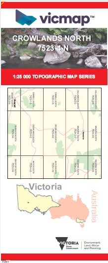
CROWLANDS NORTH 1-25,000 Vicmap Map 7523-4-N
Price range: $14.00 through $26.00
Description:
CROWLANDS NORTH 1-25,000 Vicmap Topographic Map 75234N Now Print On Demand is used for Walking, 4WD, Fishing, Camping, Motorcycle, both On and Off Road, Gold Prospecting and for those simply going for a family weekend drive.
This is a new series of 1-25,000 scale maps, all of Victoria is now covered by these maps, including maps over the South Australian and NSW Borders.
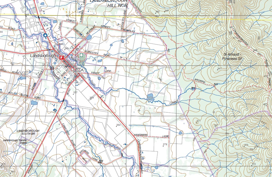
Topographical maps show not only Contours of the Terrain but Walking Tracks, Sealed and Unsealed Roads, Rivers, Creeks, Lakes, Historical Points of Interest, Old Mine Sites, mbtg and National and State Park areas.
Main Features of this map includes:
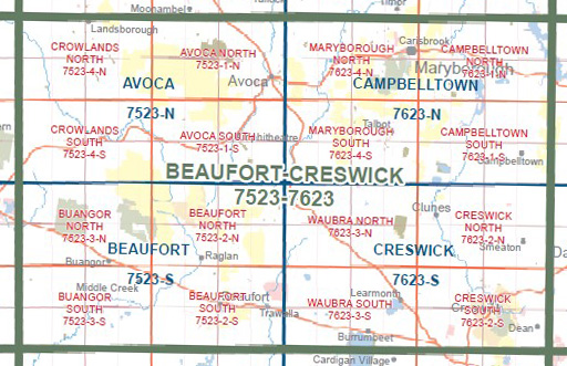
Covers the old series Crowlands North at the same scale and area
Joel Joel, Landsborough, St Arnaud – Pyrenees SF, Glenlofty, Landsborough West, Joel Joel South, Salt Patch Track, Wild Dog Track, Youth Creek, Astons Scour BR, mbtg, Shays Flat BR, Squatters Track, Blue Mountain Track, Landsborough Ridge Track, Malakoff Track, Framptons, Part of The Great Dividing Range, Laidlan Track, mbtg, Pyrenees Endurance Walk, Glendhu HR, Crowlands NFR, Hankin Track.
You may also like…
-
CROWLANDS SOUTH 1-25,000 Vicmap Topo Map 7523-4-S
Price range: $14.00 through $26.00Select options This product has multiple variants. The options may be chosen on the product page -
The Pyrenees Touring Map Meridian Edition 1
Price range: $15.95 through $26.95Select options This product has multiple variants. The options may be chosen on the product page -
Crowlands North 1-25,000 Vicmap Old Series
Select options This product has multiple variants. The options may be chosen on the product page