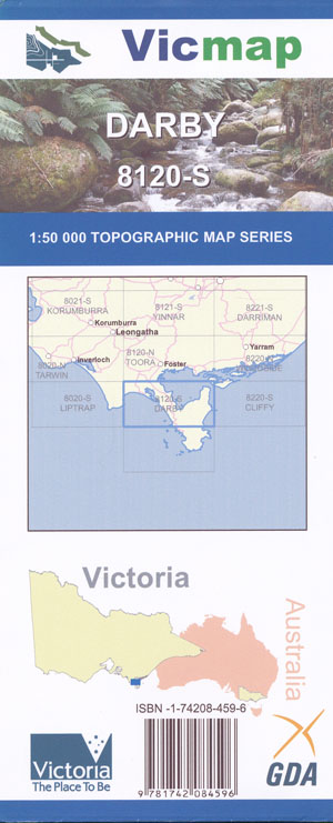
Darby 1-50,000 Vicmap
Price range: $12.00 through $24.00
Description:
Darby 1-50,000 scale Vicmap Topographical map 8120S is used for Walking, 4WD, Fishing, Camping, Motorcycle, both On and Off Road, Gold Prospecting and for those simply going for a family weekend drive.
Topographical maps show not only Contours of the Terrain but Walking Tracks, Sealed and Unsealed Roads, Rivers, Creeks, Lakes, Historical Point of Interest, Old Mine Sites mbtg and National and State Park areas.
Main Features of this map include:
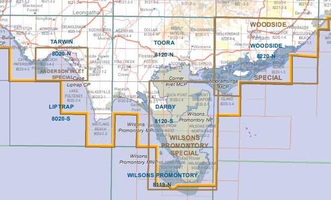
Part of Snake Island
Yanakie Caravan Park, Doughboy Island, Duck Point, Townsend Point, CORNER INLET MCP, Granite Island, CHINAMAN KNOB, MOUNT MARGARET, Milne Track, Wilsons Promontory Wilderness Zone, MOUNT HUNTER, Tin Mine Cove Campsite, MOUNT SINGAPORE, The Huts Camping Area, Entrance Point Reference Area (no public access), Whale Rock, Bentley Point, mbtg, Waratah Bay, Shellback Island, BIG HUMMOCK, Tongue Point, Sparkes Lookout, Darby Saddle, Starvation Flat, Silver Swamp, Telegraph Swamp, Corner Island and Corner Inlet, VEREKER OUTLOOK, Southern Wilsons Promontory Remote and Natural Area, MOUNT LEONARD, BANYALLA PEAK, MOUNT VEREKER, Mount Vereker Creek Natural Catchment Area, MOUNT LATROBE
Sugar Basin Swamp, FIVE MILE PEAK, Mount Vereker Creek Natural Catchment Area, MOUNT LATROBE, THE CATHEDRAL, Three Mile Point, MOUNT ROUNDBACK, Johnny Souey Cove Campsite, Miranda Bay, Rabbit Island, mbtg, Yanakie, Waratah Bay, Waratah, Waratah North, Shallow Inlet, Cape Liptrap, CAPE LIPTRAP Coastal Park, Waratah Bay Caravan Park, Walkerville, Walkerville Caravan Park, Sandy Point, Shallow Inlet Caravan Park, CORNER INLET MCP
Most of Wilsons Prom (Northern Section ONLY)
ISBN 9781742084596
You may also like…
-
DARBY NORTH 1-25,000 Vicmap Topo Map 8120-2-N
Price range: $14.00 through $26.00Select options This product has multiple variants. The options may be chosen on the product page -
Sale!
Vicmap South East Region Map Book Spatial Vision
Original price was: $95.00.$75.00Current price is: $75.00. -
South Gippsland Wilsons Promontory Map Rooftop
Price range: $11.95 through $25.00Select options This product has multiple variants. The options may be chosen on the product page -
Tarwin 1-50,000 Vicmap Topographical Map 8020-N
Price range: $14.00 through $26.00Select options This product has multiple variants. The options may be chosen on the product page -
Liptrap 1-50,000 Vicmap
Price range: $12.00 through $24.00Select options This product has multiple variants. The options may be chosen on the product page -
Wilsons Promontory Map Spatial Vision
Price range: $19.95 through $28.95Select options This product has multiple variants. The options may be chosen on the product page -
Andersons Inlet 1-25,000 Vicmap Topographic Map
Price range: $14.00 through $26.00Select options This product has multiple variants. The options may be chosen on the product page -
DARBY SOUTH 1-25,000 Vicmap Topo Map 8120-3-S
Price range: $14.00 through $26.00Select options This product has multiple variants. The options may be chosen on the product page -
Toora 1-50,000 Vicmap
Price range: $12.00 through $24.00Select options This product has multiple variants. The options may be chosen on the product page