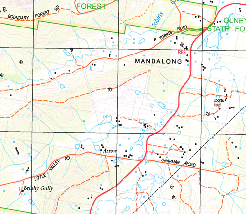
Dooralong 1-25,000 NSW Topographic Map
$16.95 – $31.95
Description:
9131-1-S Print on Demand
Locations within this Map
Debarry Kimbad Bebeah Kingtree Langton Gate Ravensdale The Daniels Cambar Valley Haven Beavendale Robinvale Thompson Vale Ravella Summerlees Farm Glen Ayr The Mount Wyee Allison Alison Armstrongs Creek Armstrongs Gully Beavens Point Bee Camp Point Ben Bridges Point Big Pole Point Blackbutt Point Boundary Point Bowmans Point Boyds Point Bradleys Point Broken Back Ridge Broken Back Spur Brush Creek Calmans Gully Calmans Point Cedar Brush Creek Christensens Point Clarks Gully Dam Point Daniels Point Dead Horse Creek Durren Durren Edwards Gully Georges Point Goldsmiths Point Harris Point Hills Gully Hughes Gully Jerrys Point Jilliby Jilliby Public School Joeys Swamp Jurds Point Calmans Creek Cedar Brush Cedar Brush Creek Public School Cedar Brush Public School Cedar Creek Clarks Creek Duralong Creek Healeys Gully Kiah Ridge Kiar Ridge Kingtree Creek Kingtree Point Left Hand Branch Lemon Tree Leos Point Little Jilliby Little Jilliby Flora Reserve Little Jilliby Jilliby Creek Long Point Lowers Gully Mandalong Mandolong Mannering Creek Martins Point Myrtle Creek The Myrtle Newcastle National Forest Old Brush Creek Olney Palm Creek Pitts Point Pole Point Right Hand Branch Rocky Gully Rocky Point Russell Splash Creek Splash Gully Spotted Gum Point Spring Creek Spring Gully Stackmans Gully Steels Gully Stinsons Creek Stinsons Gully Stinsons Point Tin Hut Point Tobins Creek Tobins Gully Warnervale Warnervale Public School Warnervale Railway Station Whitemans Gully Window Pane Gully Woodards Point Wyee Platform Wyee Public School Wyee Railway Station Wyong Wyong Cemetery Wyong Creek Wyong General Cemetery Wyong National Forest Wyong River Wyong State Forest Yambo Yarramalong Yarramalong Public School Yarramalong Valley Youngs Creek Youngs Gully Bumbles Creek Bumble Hill Dixons Gully Dooralong Dooralong Public School Duffys Point Digary Creek Bungalow Flat Bunning Creek Burning Creek Buttonderry Creek Byrons Gully Cootes Point Coutts Gully Coutts Point Goldies Spur Little Jilliby Ridge Smiths Point Bushells Ridge Kiar Jack Gear Reserve Walmsleys Corner Wallarah Woongarrah Halloran Woongarrah Public School Resthaven Schofields Gully Bradleys Creek Lakeside
| Scale: | 1:25000 |
| Latitude Range: | 33° 7.5′ S – 33° 15.0′ S |
| Longitude Range: | 151° 15.0′ E – 151° 30.0′ E |
| Datum: | GDA 94 |
| Approx Print Size: | 0.56m X 1.11m |


