Grampians National Park Touring Map Spatial Vision
$11.95
Description:
Grampians National Park Touring Map Spatial Vision
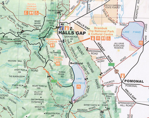
The whole of the Grampians National Park and surrounds is covered by this detailed touring map including Cavendish, Balmoral, Dunkeld, Wartook, Dadswells Bridge, Stawell, Moyston and everything in between.
Features include roads, 4WD tracks, National & State Park boundaries, State Forests, watercourses, lakes, swamps, and lots of tourist facilities.
- Revised Edition December 2021
- Grampians National Park
- Black Range State Park
- Rockland Reservoir
- Shows facilities, rock art, campgrounds, picnic grounds, views and more
- Safety and other information about Grampians National Park
- Also available Wonderland/Central, Southern & Northern Walks Maps, and the Grampians Peak Trail Maps
ISBN 9780731181742
Read More