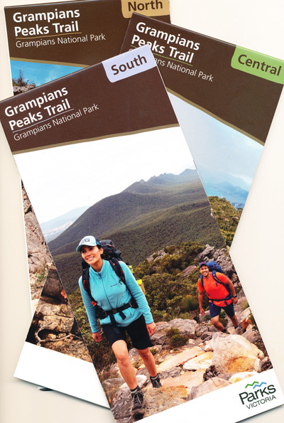
Grampians Peaks Trail Map Set 3 Maps
Price range: $26.95 through $50.95
Description:
Grampians Peak Trail 3 Map Set
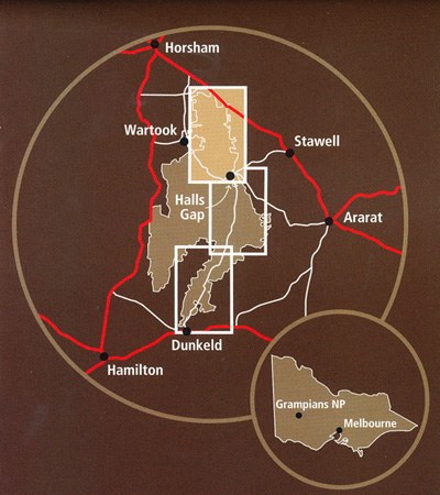
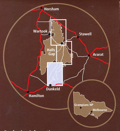
The Grampians Peak Trail is a 164km, multi-day walk which showcases the many and varied features on the offer across the Grampians National Park. The trail has been designed as a 13-day/12-night hiking experience from Mt Zero in the north to Dunkeld in the south, with unique hike-in campgrounds to enjoy along the route. The trail has been designed to provide varying experiences for multiple user groups including day walkers, independent walkers, walking groups, guided walkers, fully facilitated walkers and school groups. Options include single-day hikes, overnight hikes (1,2 or 3 nights), as well as the entire 13-day 164km experience. walkers will experience climbs to dramatic mountain peaks, rugged rocky ridgelines, the diversity of the park’s flora and the ancient Aboriginal culture of the Gariwerd.
- 1st Edition Revised 2022
- Scale 1:50,000
- Full set of topographic maps
- Shows Campsites, Access Points, facilities and more
- Must have maps for the Trail experience
- Informative text about the walk
- Descriptions of side trips
- Also available as individual maps – North, Central & South
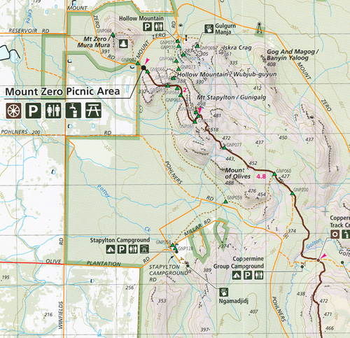
North Map
Baigar, Gar (Roses Gap), Troopers Creek, Zumsteins Picnic Area, MacKenzie Falls, Burrong Falls, Reed Lookout, Dad’s Lookout, Lake Wartook Werdug, Mount Difficult, Stayplton Campground , Hollow Mountain, Golton Gorge Picnic Area, Coppermine Track Crossing, Beehive Falls, Lake Wrtook Lookout, Halls Gap, Heaterlie Quarry, Long Point West and East Campgrounds, Ngarrain, Boroka Lookout Brambuk Cultural Centre, The Balconies, Wonderland Car Park, Smiths Mill Campground Dadswell Bridge
Central Map
Halls Gap, Buggia, Mt Rosea Carpark, Redman Road, Duwul, Reed Lookout, Mt William Carpark, The Basin, Tunnel Walk Carpark, Pomonal, Brambuk Cultural Centre, Sundail Carpark, Hawks Carpark, The Pinnacle, Wonderland Carpark, The Balconies, Barri Yalug, Bovine Hills, Lake Fyan, Durd Durd, Kalyma Campground, Boundary Gap, First Wonnon Campground, Mafeking Picnic Area, Yarram, Jimmy Creek Campground, Yarram Gap Road, Mt Burchell, Mt Nelson, Mt Lang, Mt Fredrick, Mt Stanley, Stockyard Saddle, Murray Hill
South Map
Jimmy Creek Campground, Mt Nelson, Mt Burchell, Mirranatwa Gap, Yarram Gap Road, Wannon, Griffin Fireline, Mt Nybor, Djardji Dwawara, Brady Swamp, Cassidy Gap Road, Mt Abrupt, Mud dadjug, Victoria Valley Road, Dunkeld, Mt Sturgeon The Picaninny Bainggug
LAMINATED SET ALSO AVAILABLE
You may also like…
-
Grampians Peaks Trail Map South
Price range: $9.95 through $24.95Select options This product has multiple variants. The options may be chosen on the product page -
Best Walks of the Gariwerd Grampians National Park
Select options This product has multiple variants. The options may be chosen on the product page -
Grampians Peaks Trail Map Central
Price range: $9.95 through $24.95Select options This product has multiple variants. The options may be chosen on the product page -
The Grampians Special 1-100,000 Topo Vicmap
Price range: $12.00 through $24.00Select options This product has multiple variants. The options may be chosen on the product page