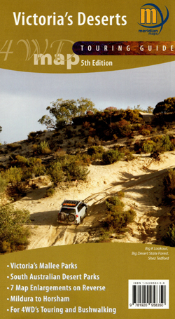
Victoria’s Deserts 4WD Map Meridian Edition 5
Price range: $15.95 through $26.95
Description:
Meridian Maps Victoria’s Deserts 4WD Map
Description
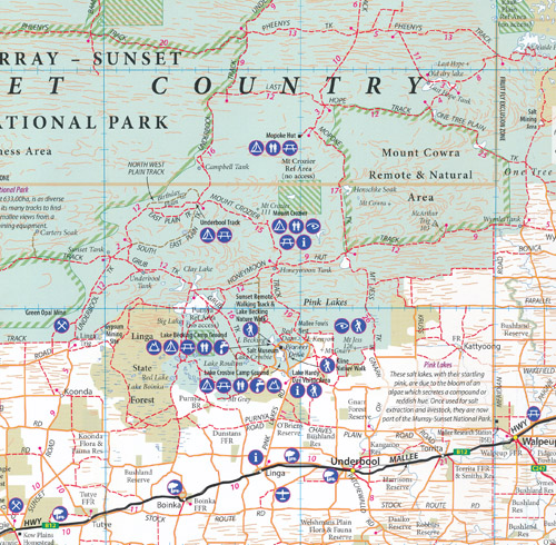
This is the most comprehensive map of Victoria’s mallee parks. Significantly updated 1:350,000 scale map covering the all the Mallee parks of Victoria from the Little Desert through to the Murray River, as well as the South Australian Desert Parks of Ngarkat and Billiatt. Also shows the Riverland region of SA. Many new tracks, road names and other features added for this edition. Now with 7 enlargements on reverse of popular areas: Little Desert, Pink Lakes, Border Track, central Wyperfeld, Lindsay & Wallpolla Islands, Raak Plain and Mt Arapiles. Ideal for four wheel drivers as it includes all the navigable tracks in the region as well as the tourist features. Great for bush walkers with the Sunset Remote Walking Track and the Desert Discovery Walk shown in detail. Covers the best of the Border Track and all the four-wheel drive tracks of the Big Desert State Park.
- 5th Edition 2020
- Scale 1:350,000
- 7 enlargements on reverse including Lindsay and Wallpolla islands and Northern Mallee in Victoria along the Murray, Raak Plain NE Murray Sunset National Park, Wyperfelf, Ngarrkat Conservation Park South Australia and Border Track, Little Desert National Park
- Latest vehicle and track information
- South Australian Desert Parks
- Walking tracks & camping areas
- Up to Date camping and tourist information
- Map size 700mm(W) x 1000mm(H) flat
- ISBN: 9781920958350
You may also like…
-
Ouyen 1-250,000 Topographic Map
Price range: $15.95 through $30.95Select options This product has multiple variants. The options may be chosen on the product page -
Hattah Kulkyne Map Guide Meridian Edition 2
Price range: $10.95 through $19.95Select options This product has multiple variants. The options may be chosen on the product page -
Hopetoun 1-50,000 Vicmap
Price range: $12.00 through $24.00Select options This product has multiple variants. The options may be chosen on the product page