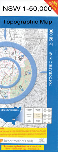
Gurley 1-50000 NSW Topographic Map
$16.95 – $31.95
Description:
Gurley 8838-N 1-50,000 scale NSW Topographical map is used for Walking, 4WD, Fishing, Camping, Motorcycle, both On and Off Road, Gold Prospecting and for those simply going for a family weekend drive.
Topographical maps show not only Contours of the Terrain but also Walking Tracks, Sealed and Unsealed Roads, Rivers, Creeks, Lakes, Historical Point of Interest, Old Mine Sites and National and State Park areas.
 We can Now LAMINATE and fold your map for $12.00. Just click on the image and add to the Trolley
NOW AVAILABLE PRINT ON DEMAND
Locations within this Map
Courallie Menadool Glen Idyll Clifton Carrington Tyrone Ogilvie Inverness Wonga The Big Waterhole Bindiar Anabranch Bindiar Gully Carlyle Lagoon Centre Creek Clarks Creek Cobban Creek Cobban Lagoon Combadelo Combadello Tank Combadello Weir Coolibah Anabranch Coolibah Lagoon Coolibah Waterholes Forest Creek Glenroy Bore Gurley Gurley Creek Gurley Railway Station Gurley Silo Gurley Tank Center Creek Cobbon Creek Coolibar Gully Coolibar Lagoon Coolibar Waterholes Courallie Creek Goona Creek Gurley Public School Gurley Station Village of Gurley Little Bumble Creek Meei River Mehi River Menadool Lagoon Minnaminane Moomin Creek Branch of Moomin Creek Nepickallina Peacumboul Smart Swamp Hollow Tycannah Tycannah Siding Tycannah Tank White Swamp White Swamp Tank The White Swamp White Swamp Watercourse Whittaker Lagoon Whittaker Lagoon Tank Whittakers Lagoon Tank Willow Dam Windoondilla Wirrigurldonga Bumble Dirty Lagoon Burranbah Wathagar Tank Kirramingly Nature Reserve Halls Creek Mungie Bundie Mia Creek Whiteswamp Tank Mia Mia Creek Weah Waa Creek Willow Park Combadello Ellerslie Romani Gurley Bore Bomuckledi
| Name: | Gurley |
| Publisher: | New South Wales Government |
| Scale: | 1:50000 |
| Latitude Range: | 29° 30.0′ S – 29° 45.0′ S |
| Longitude Range: | 149° 30.0′ E – 150° 0.0′ E |
| Datum: | GDA 94 |

